Junta de Freguesia da União das Freguesias de Montijo e Afonsoeiro
Junta de Freguesia da União das Freguesias de Montijo e Afonsoeiro is a town hall in Montijo e Afonsoeiro, Montijo, Setúbal District which is located on Rua Ilha do Príncipe. Junta de Freguesia da União das Freguesias de Montijo e Afonsoeiro is situated nearby to the police station GNR - Destacamento Territorial do Montijo, as well as near the shopping center Centro Comercial Bela Vista.| Tap on a place to explore it |
- Opening hours: Monday—Friday 9:00 AM—12:30 PM and 2:00 PM—5:30 PM
- Email: geraldelegacao@jf-montijoeafonsoeiro.pt
- Type: Town hall
- Address: Rua Ilha do Príncipe 2, Montijo, 2870-822
Places of Interest Nearby
Highlights include Ermida de São Sebastião and Igreja da Misericórdia do Montijo.
Ermida de São Sebastião
Church

Photo: Pedro S Bello, CC BY-SA 4.0.
Ermida de São Sebastião is a church, which is situated 1½ km northwest of Junta de Freguesia da União das Freguesias de Montijo e Afonsoeiro.
Igreja da Misericórdia do Montijo
Church

Photo: Pedro S Bello, CC BY-SA 4.0.
Igreja da Misericórdia do Montijo is a church, which is situated 2 km northwest of Junta de Freguesia da União das Freguesias de Montijo e Afonsoeiro.
Moinho de Maré da Lançada
Building

Photo: AGoulart, CC BY-SA 4.0.
Moinho de Maré da Lançada is a building, which is situated 1 km south of Junta de Freguesia da União das Freguesias de Montijo e Afonsoeiro.
Places in the Area
Nearby places include Sarilhos Grandes and Samouco.

Samouco
Town
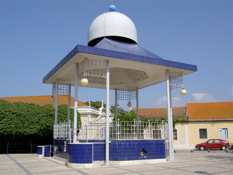
Photo: Dougal2010, CC BY-SA 3.0.
Samouco is a town, which is situated 5 km northwest of Junta de Freguesia da União das Freguesias de Montijo e Afonsoeiro.
Gaio-Rosário
Village

Photo: Link88, Public domain.
Gaio-Rosário is a village, which is situated 5 km southwest of Junta de Freguesia da União das Freguesias de Montijo e Afonsoeiro.
Junta de Freguesia da União das Freguesias de Montijo e Afonsoeiro
- Categories: building and government building
- Location: Montijo e Afonsoeiro, Montijo, Setúbal District, Portugal, Iberia, Europe
- View on OpenStreetMap
Latitude
38.69825° or 38° 41′ 54″ northLongitude
-8.95448° or 8° 57′ 16″ westOpen location code
8CCHM2XW+76OpenStreetMap ID
way 328032957OpenStreetMap feature
amenity=townhallOpenStreetMap feature
building=yes
This page is based on OpenStreetMap, Wikidata, and Wikimedia Commons.
We’d love your help improving our open data sources. Thank you for contributing.
Satellite Map
Discover Junta de Freguesia da União das Freguesias de Montijo e Afonsoeiro from above in high-definition satellite imagery.
Places with the Same Name
Discover other places named “Junta de Freguesia da União das Freguesias de Montijo e Afonsoeiro”.
Notable Places Nearby
Highlights include GNR - Destacamento Territorial do Montijo and Centro Comercial Bela Vista.
Nearby Places
Explore places such as Casa do Choco and Café Sollua.
Portugal: Must-Visit Destinations
Delve into Lisbon, Caldas da Rainha, Porto, and Coimbra.
Curious Town Halls to Discover
Uncover intriguing town halls from every corner of the globe.
About Mapcarta. Data © OpenStreetMap contributors and available under the Open Database License". Text is available under the CC BY-SA 4.0 license, except for photos, directions, and the map. Photo: Vitor Oliveira, CC BY-SA 2.0.