Buschenschank Christiner Erich
Buschenschank Christiner Erich is a restaurant in Riegersburg, Südoststeiermark District, Styria. Buschenschank Christiner Erich is situated nearby to the village Lödersdorf, as well as near the hamlet Raabau.| Tap on a place to explore it |
- Type: Restaurant
- Cuisine: Buschenschank
- Address: 23, Oberkornbach, Riegersburg, 8334
Places of Interest Nearby
Highlights include Pfarrkirche Riegersburg and Jüdische Grabsteine Steinberg.
Pfarrkirche Riegersburg
Church

Photo: Nxr-at, CC BY-SA 4.0.
Pfarrkirche Riegersburg is a church, which is situated 3½ km north of Buschenschank Christiner Erich.
Jüdische Grabsteine Steinberg
Cemetery
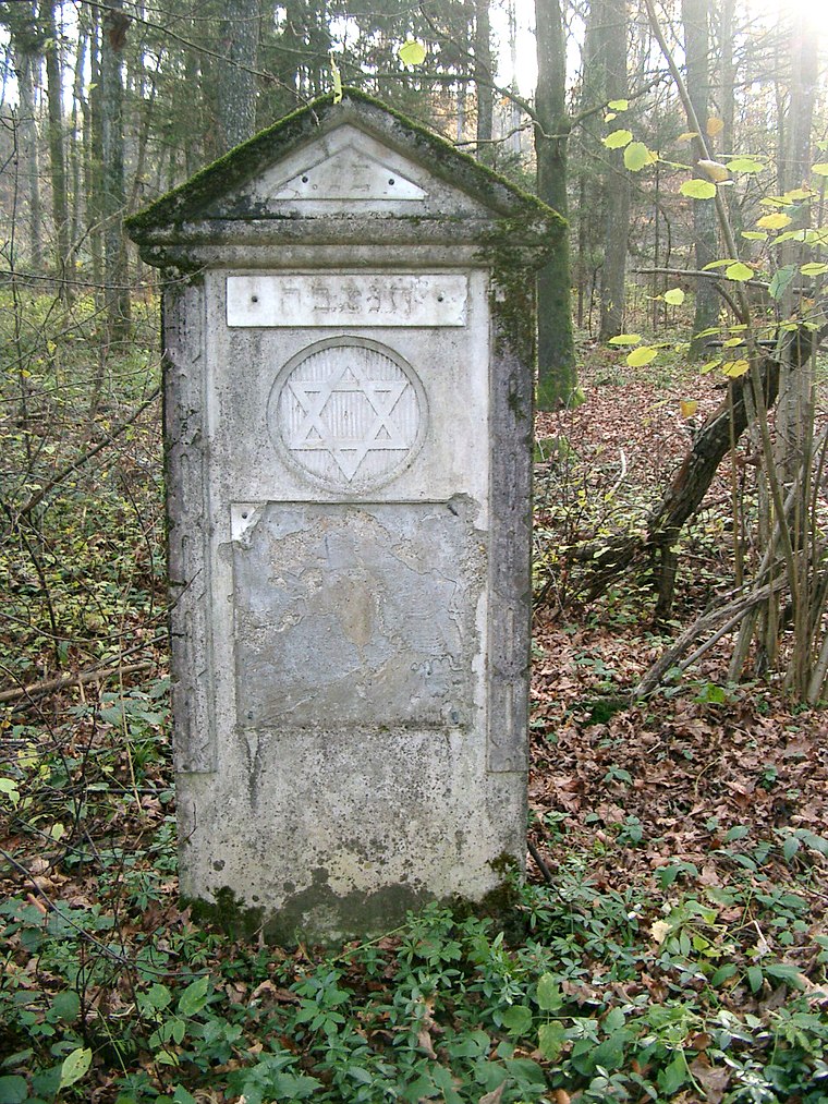
Photo: E.mil.mil, CC BY-SA 3.0.
Jüdische Grabsteine Steinberg is a cemetery, which is situated 4 km southwest of Buschenschank Christiner Erich.
Rosegger Denkmal
Memorial

Photo: Robert Heilinger, CC BY-SA 3.0.
Rosegger Denkmal is a memorial, which is situated 3½ km north of Buschenschank Christiner Erich.
Places in the Area
Nearby places include Lödersdorf and Raabau.
Lödersdorf
Village
 Lödersdorf is a former municipality in the district of Südoststeiermark in the Austrian state of Styria. Since the 2015 Styria municipal structural reform, it is part of the municipality Riegersburg.
Raabau
Hamlet
Raabau is a former municipality in the district of Südoststeiermark in the Austrian state of Styria. Since the 2015 Styria municipal structural reform, it is part of the municipality Feldbach. Raabau is situated 2½ km southwest of Buschenschank Christiner Erich.
Leitersdorf im Raabtal
Village
Leitersdorf im Raabtal is a former municipality in the district of Südoststeiermark in the Austrian state of Styria. Since the 2015 Styria municipal structural reform, it is part of the municipality Feldbach. Leitersdorf im Raabtal is situated 3½ km south of Buschenschank Christiner Erich.
Buschenschank Christiner Erich
- Categories: building, commercial building, and food
- Location: Riegersburg, Südoststeiermark District, Styria, Austria, Central Europe, Europe
- View on OpenStreetMap
Latitude
46.97144° or 46° 58′ 17″ northLongitude
15.94155° or 15° 56′ 30″ eastOpen location code
8FRQXWCR+HJOpenStreetMap ID
way 329673616OpenStreetMap feature
amenity=restaurantOpenStreetMap feature
building=commercialOpenStreetMap attribute
cuisine=buschenschank
This page is based on OpenStreetMap, Wikidata, and Wikimedia Commons.
We’d love your help improving our open data sources. Thank you for contributing.
Satellite Map
Discover Buschenschank Christiner Erich from above in high-definition satellite imagery.
Notable Places Nearby
Highlights include Waldrestaurant Lödersdorf and Gemeindezentrum Lödersdorf.
Nearby Places
Explore places such as Station #34 and Rupert Temmel.
Styria: Must-Visit Destinations
Delve into Graz, Leoben, Bruck an der Mur, and Kapfenberg.
Curious Restaurants to Discover
Uncover intriguing restaurants from every corner of the globe.
About Mapcarta. Data © OpenStreetMap contributors and available under the Open Database License". Text is available under the CC BY-SA 4.0 license, except for photos, directions, and the map. Photo: Kmarka, CC BY-SA 3.0.