Friedhof ‘Gottesacker’
Friedhof ‘Gottesacker’ is a cemetery in Saalburg-Ebersdorf, Saale-Orla-Kreis, Thuringia. Friedhof ‘Gottesacker’ is situated nearby to the pond Pohligteich, as well as near the community center Evangelisches Rüstzeitenheim Sonnenschein.| Tap on a place to explore it |
Places of Interest Nearby
Highlights include St. Christophorus and Schloss Bellevue.
St. Christophorus
Church

Photo: Subbass1, CC BY-SA 4.0.
St. Christophorus is a church, which is situated 580 metres north of Friedhof ‘Gottesacker’.
Schloss Bellevue
Castle
 Schloss Bellevue is a castle, which is situated 1 km west of Friedhof ‘Gottesacker’.
St. Marien
Church

Photo: Wikimedia, CC BY-SA 4.0.
St. Marien is a church, which is situated 1½ km southwest of Friedhof ‘Gottesacker’.
Places in the Area
Nearby places include Ebersdorf and Schönbrunn (Saalburg-Ebersdorf).

Schönbrunn (Saalburg-Ebersdorf)
Village
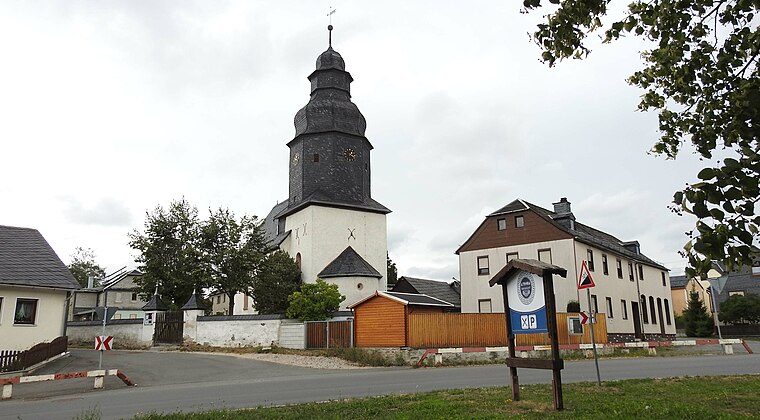
Photo: Flodur63, CC BY-SA 4.0.
Schönbrunn (Saalburg-Ebersdorf) is a village.

Friedhof ‘Gottesacker’
- Type: Cemetery
- Category: burial
- Location: Saalburg-Ebersdorf, Saale-Orla-Kreis, Thuringia, Germany, Central Europe, Europe
- View on OpenStreetMap
Latitude
50.48028° or 50° 28′ 49″ northLongitude
11.66955° or 11° 40′ 10″ eastOpen location code
9F2HFMJ9+4ROpenStreetMap ID
way 332124772OpenStreetMap feature
landuse=cemetery
This page is based on OpenStreetMap, Wikidata, and Wikimedia Commons.
We’d love your help improving our open data sources. Thank you for contributing.
Satellite Map
Discover Friedhof ‘Gottesacker’ from above in high-definition satellite imagery.
Notable Places Nearby
Highlights include Pohligteich and Evangelisches Rüstzeitenheim Sonnenschein.
Nearby Places
Explore places such as Ruhmühle and Der gefallenen Söhne.
Curious Cemeteries to Discover
Uncover intriguing cemeteries from every corner of the globe.
About Mapcarta. Data © OpenStreetMap contributors and available under the Open Database License". Text is available under the CC BY-SA 4.0 license, except for photos, directions, and the map. Photo: Taxiarchos228, FAL.