střelnice v Rakovníku
střelnice v Rakovníku is a public building in Rakovník, Central Bohemia. střelnice v Rakovníku is situated nearby to the sports venue U Kamenné Panny, as well as near Socha svatého Vojtěcha.| Tap on a place to explore it |
Places of Interest Nearby
Highlights include Town hall in Rakovník and Muzeum T. G. Masaryka.
Town hall in Rakovník
Town hall
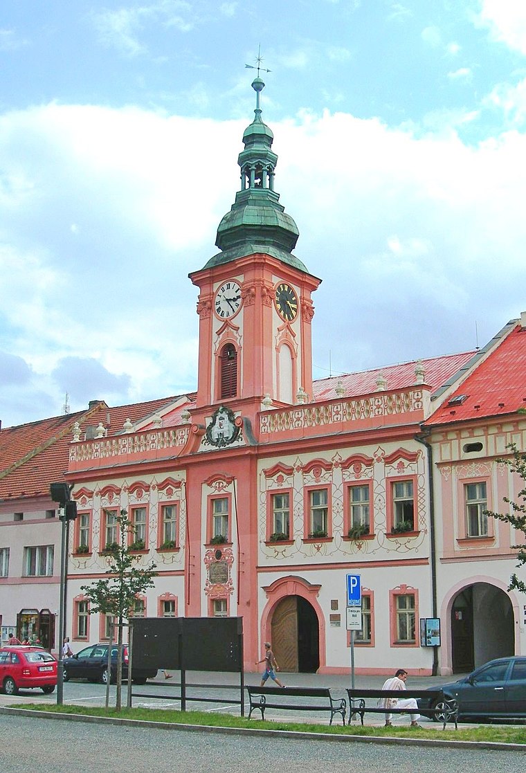
Photo: Wikimedia, CC BY-SA 3.0.
Town hall in Rakovník is situated 1½ km south of střelnice v Rakovníku.
Muzeum T. G. Masaryka
Museum

Photo: ŠJů, CC BY-SA 3.0.
Muzeum T. G. Masaryka is a museum, which is situated 1½ km south of střelnice v Rakovníku.
Hlavačov
Ruins

Photo: Petr Kinšt, CC BY-SA 4.0.
Hlavačov is a ruins, which is situated 1 km north of střelnice v Rakovníku.
Places in the Area
Nearby places include Lužná and Olešná.
Lužná
Village
 Lužná is a municipality and village in Rakovník District in the Central Bohemian Region of the Czech Republic. It has about 2,000 inhabitants. Lužná is situated 3 km east of střelnice v Rakovníku.
Olešná
Village
 Olešná is a municipality and village in Rakovník District in the Central Bohemian Region of the Czech Republic. It has about 600 inhabitants. Olešná is situated 3 km northwest of střelnice v Rakovníku.
Lišany
Village
 Lišany is a municipality and village in Rakovník District in the Central Bohemian Region of the Czech Republic. It has about 700 inhabitants. Lišany is situated 3½ km north of střelnice v Rakovníku.
střelnice v Rakovníku
- Type: Public building
- Categories: building and government building
- Location: Rakovník, Rakovník District, Central Bohemia, Czech Republic, Central Europe, Europe
- View on OpenStreetMap
Latitude
50.11664° or 50° 6′ 60″ northLongitude
13.73262° or 13° 43′ 57″ eastLevels
1Open location code
9F2M4P8M+M2OpenStreetMap ID
way 333121310OpenStreetMap feature
building=civic
This page is based on OpenStreetMap, Wikidata, and Wikimedia Commons.
We’d love your help improving our open data sources. Thank you for contributing.
Satellite Map
Discover střelnice v Rakovníku from above in high-definition satellite imagery.
Notable Places Nearby
Highlights include U Kamenné Panny and Socha svatého Vojtěcha.
Nearby Places
Explore places such as Dřevospektrum and Rakovník, rozcestí Cikánka.
Central Bohemia: Must-Visit Destinations
Delve into Prague, Kutná Hora, Kladno, and Mladá Boleslav.
Curious Public Buildings to Discover
Uncover intriguing public buildings from every corner of the globe.
About Mapcarta. Data © OpenStreetMap contributors and available under the Open Database License". Text is available under the CC BY-SA 4.0 license, except for photos, directions, and the map. Photo: Zdeněk Fiedler, CC BY-SA 3.0.