Iglesia de la Inmaculada Concepción
Iglesia de la Inmaculada Concepción is a church in San Sebastián de los Ballesteros, Córdoba, Andalusia. Iglesia de la Inmaculada Concepción is situated nearby to the town hall Ayuntamiento de San Sebastián de los Ballesteros, as well as near the park Plaza del Fuero.| Tap on a place to explore it |
Places in the Area
Nearby places include San Sebastián de los Ballesteros and La Victoria.
San Sebastián de los Ballesteros
Village

Photo: 19Tarrestnom65, CC BY-SA 4.0.
San Sebastián de los Ballesteros is a municipality located in the province of Córdoba, Spain. According to the 2006 census, the city has a population of 836 inhabitants.
La Victoria
Village

Photo: Cordoman, CC BY-SA 4.0.
La Victoria is a municipality in the province of Córdoba, Spain. In the year 2011 its population was 2,336. It has an area of 20 square kilometres and a population density of 120/km2. La Victoria is situated 4 km northwest of Iglesia de la Inmaculada Concepción.
La Guijarrosa
Village
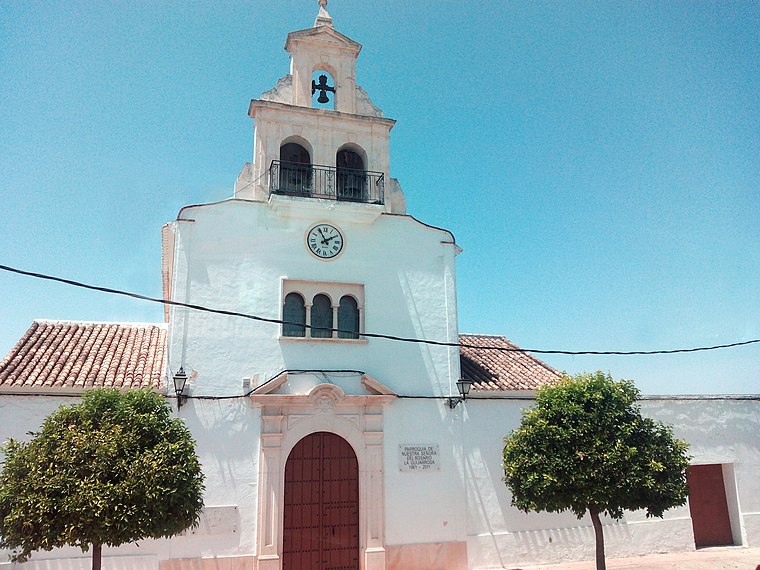
Photo: Hameryko, CC BY-SA 4.0.
La Guijarrosa is a municipality located in the Province of Córdoba, in the autonomous community of Andalusia, Spain. It was an independent local entity within the municipality of Santaella, until 2018 when it was constituted as an independent municipality. La Guijarrosa is situated 4 km southwest of Iglesia de la Inmaculada Concepción.
Iglesia de la Inmaculada Concepción
- Type: Church
- Denomination: Catholic
- Categories: building, place of worship, and religion
- Location: San Sebastián de los Ballesteros, Córdoba, Andalusia, Spain, Iberia, Europe
- View on OpenStreetMap
Latitude
37.65464° or 37° 39′ 17″ northLongitude
-4.82513° or 4° 49′ 31″ westOpen location code
8C9QM53F+VWOpenStreetMap ID
way 334364584OpenStreetMap feature
amenity=place_of_worshipOpenStreetMap feature
building=yesOpenStreetMap attribute
denomination=catholic
This page is based on OpenStreetMap, Wikidata, and Wikimedia Commons.
We’d love your help improving our open data sources. Thank you for contributing.
Satellite Map
Discover Iglesia de la Inmaculada Concepción from above in high-definition satellite imagery.
Places with the Same Name
Discover other places named “Iglesia de la Inmaculada Concepción”.
Notable Places Nearby
Highlights include Ayuntamiento de San Sebastián de los Ballesteros and Mercado de Abastos.
Nearby Places
Explore places such as Caja Rural and CajaSur.
Córdoba: Must-Visit Destinations
Delve into Córdoba, Puente Genil, and Iznájar.
Curious Churches to Discover
Uncover intriguing churches from every corner of the globe.
About Mapcarta. Data © OpenStreetMap contributors and available under the Open Database License". Text is available under the CC BY-SA 4.0 license, except for photos, directions, and the map. Photo: Mitch Vander Vorst, CC BY 2.0.