Sankt Georgen Friedhof
Sankt Georgen Friedhof is a cemetery in Brandenburg, Germany. Sankt Georgen Friedhof is situated nearby to the square Beethovenplatz, as well as near Berliner Tor.| Tap on a place to explore it |
Places of Interest Nearby
Highlights include Berliner Tor and St George’s chapel (Templin).
Berliner Tor

Photo: Brunhilde Schaefer, CC BY-SA 3.0.
Berliner Tor is situated 260 metres northeast of Sankt Georgen Friedhof.
St George’s chapel (Templin)
Church
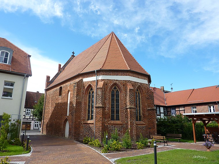 St George’s chapel (Templin) is a church, which is situated 300 metres northeast of Sankt Georgen Friedhof.
Pulverturm

Photo: Wikimedia, CC BY-SA 4.0.
The Pulverturm in Templin is a tower on the old town fortifications of Templin in Brandenburg. It is located in the eastern part of Templin's Altstadt not far from the Prenzlau Gate. Pulverturm is situated 620 metres northeast of Sankt Georgen Friedhof.
Places in the Area
Nearby places include Templin and Hammelspring.
Templin
Town

Photo: Oktaeder, Public domain.
Templin is a small town in the Uckermark district of Brandenburg, Germany. Though it has a population of only 17,127, in terms of area it is, with 377.01 km2, the second largest town in Brandenburg and the seventh largest town in Germany.
Hammelspring
Village

Photo: Hans G. Oberlack, CC BY-SA 4.0.
Hammelspring is a village, which is situated 7 km southwest of Sankt Georgen Friedhof.
Gandenitz
Village

Photo: DorisAntony, CC BY-SA 4.0.
Gandenitz is a village, which is situated 7 km northwest of Sankt Georgen Friedhof.
Sankt Georgen Friedhof
- Type: Cemetery
- Category: burial
- Location: Brandenburg, Germany, Central Europe, Europe
- View on OpenStreetMap
Latitude
53.11604° or 53° 6′ 58″ northLongitude
13.49688° or 13° 29′ 49″ eastOpen location code
9F5M4F8W+CQOpenStreetMap ID
way 335864963OpenStreetMap feature
landuse=cemetery
This page is based on OpenStreetMap, Wikidata, and Wikimedia Commons.
We’d love your help improving our open data sources. Thank you for contributing.
Satellite Map
Discover Sankt Georgen Friedhof from above in high-definition satellite imagery.
Notable Places Nearby
Highlights include Beethovenplatz and Familien-Kompetenz-Centrum.
Nearby Places
Explore places such as Blumen Behrendt and Friederike Krüger.
Brandenburg: Must-Visit Destinations
Delve into Potsdam, Cottbus, Frankfurt an der Oder, and Brandenburg an der Havel.
Curious Cemeteries to Discover
Uncover intriguing cemeteries from every corner of the globe.
About Mapcarta. Data © OpenStreetMap contributors and available under the Open Database License". Text is available under the CC BY-SA 4.0 license, except for photos, directions, and the map. Photo: Leviathan1983, CC BY-SA 3.0.