Kleingartenverein Moorbreite
Kleingartenverein Moorbreite is an allotment garden in Wolfsburg, Brunswick Land, Lower Saxony. Kleingartenverein Moorbreite is situated nearby to Reit- und Fahrverein Vorsfelde, as well as near the church Kirchengemeinde Johannes Vorsfelde.| Tap on a place to explore it |
Places of Interest Nearby
Highlights include Burg Neuhaus and Allersee.
Burg Neuhaus
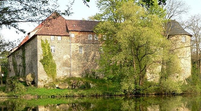
Photo: Axel Hindemith, Public domain.
Burg Neuhaus is situated 1½ km southeast of Kleingartenverein Moorbreite.
Allersee
Lake
 Allersee is a lake in Wolfsburg, Lower Saxony, Germany. At an elevation of 57 m, its surface area is 3.321 km2.
Allerpark
Park
 The Allerpark is a public leisure park in the German city of Wolfsburg. It is located between the districts of Wolfsburg-Reislingen, Wolfsburg-Vorsfelde, Wolfsburg-Nordstadt and Wolfsburg-Stadtmitte. Allerpark is situated 2 km northwest of Kleingartenverein Moorbreite.
Places in the Area
Nearby places include Vorsfelde and Steimker Gärten.


Teichbreite
Suburb

Photo: Upsala, CC BY-SA 3.0.
Teichbreite is a suburb, which is situated 2½ km northwest of Kleingartenverein Moorbreite.
Kleingartenverein Moorbreite
- Type: Allotment garden
- Location: Wolfsburg, Brunswick Land, Lower Saxony, Germany, Central Europe, Europe
- View on OpenStreetMap
Latitude
52.42816° or 52° 25′ 41″ northLongitude
10.84471° or 10° 50′ 41″ eastOpen location code
9F4GCRHV+7VOpenStreetMap ID
way 336887495OpenStreetMap feature
landuse=allotments
This page is based on OpenStreetMap, Wikidata, and Wikimedia Commons.
We’d love your help improving our open data sources. Thank you for contributing.
Satellite Map
Discover Kleingartenverein Moorbreite from above in high-definition satellite imagery.
Notable Places Nearby
Highlights include Reit- und Fahrverein Vorsfelde and Kirchengemeinde Johannes Vorsfelde.
Nearby Places
Explore places such as Spielplatz 5209 Bolzplatz Moorbreite and Moorbreite.
Brunswick Land: Must-Visit Destinations
Delve into Brunswick, Salzgitter, Wolfenbüttel, and Helmstedt.
Curious Allotment Gardens to Discover
Uncover intriguing allotment gardens from every corner of the globe.
About Mapcarta. Data © OpenStreetMap contributors and available under the Open Database License". Text is available under the CC BY-SA 4.0 license, except for photos, directions, and the map. Photo: Richard Bartz, CC BY-SA 3.0.