Schützen-Bollen-Haus
Schützen-Bollen-Haus is a building in Schwalbach, Saarlouis, Saarland. Schützen-Bollen-Haus is situated nearby to the meadow Zeltplatz der Pfadfinder Hülzweiler, as well as near the church St. Laurentius Kapelle.| Tap on a place to explore it |
Places of Interest Nearby
Highlights include Saar Polygon and St. Martin (Schwalbach (Saar)).
Saar Polygon
Scenic viewpoint

Photo: Milseburg, CC BY-SA 4.0.
The Saar Polygon in Ensdorf, Saarland is a monument commemorating the coal mining industry in Saarland, which ended in June 2012. Saar Polygon is situated 3 km west of Schützen-Bollen-Haus.
St. Martin (Schwalbach (Saar))
Church
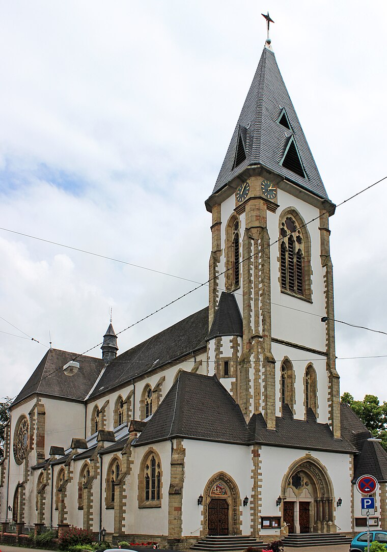
Photo: Mstp77, CC BY-SA 3.0.
St. Martin (Schwalbach (Saar)) is a church, which is situated 2½ km south of Schützen-Bollen-Haus.
St. Josef (Saarlouis)
Church

Photo: Matthwiki, CC BY-SA 3.0 de.
St. Josef (Saarlouis) is a church, which is situated 3 km west of Schützen-Bollen-Haus.
Places in the Area
Nearby places include Schwalbach and Saarwellingen.
Schwalbach
Village
Photo: Mstp77, CC BY-SA 3.0.
Schwalbach is a municipality in the district of Saarlouis, in Saarland, Germany. It is situated approximately 5 km east of Saarlouis, and 15 km northwest of Saarbrücken. Schwalbach is situated 2½ km south of Schützen-Bollen-Haus.
Saarwellingen
Village
 Saarwellingen is a municipality in the district of Saarlouis in Saarland, Germany. As of 2022 it has a population of 13,302. Saarwellingen is situated 3 km north of Schützen-Bollen-Haus.
Elm
Village

Photo: Mstp77, CC BY-SA 3.0.
Elm is a village, which is situated 3½ km southeast of Schützen-Bollen-Haus.
Schützen-Bollen-Haus
- Type: Building
- Location: Schwalbach, Saarlouis, Saarland, Germany, Central Europe, Europe
- View on OpenStreetMap
Latitude
49.32561° or 49° 19′ 32″ northLongitude
6.82218° or 6° 49′ 20″ eastOpen location code
8FX88RGC+6VOpenStreetMap ID
way 336919201OpenStreetMap feature
building=yes
This page is based on OpenStreetMap, Wikidata, and Wikimedia Commons.
We’d love your help improving our open data sources. Thank you for contributing.
Satellite Map
Discover Schützen-Bollen-Haus from above in high-definition satellite imagery.
Notable Places Nearby
Highlights include Zeltplatz der Pfadfinder Hülzweiler and St. Laurentius Kapelle.
Nearby Places
Explore places such as Parkplatz des Pfadfinderheims and Pfadfinderheim DPSG Hülzweiler.
Saarland: Must-Visit Destinations
Delve into Saarbrücken, Saarlouis, Homburg, and Merzig.
Curious Buildings to Discover
Uncover intriguing buildings from every corner of the globe.
About Mapcarta. Data © OpenStreetMap contributors and available under the Open Database License". Text is available under the CC BY-SA 4.0 license, except for photos, directions, and the map. Photo: wolfgangstaudt, CC BY 2.0.