LPG Bördeland eG
LPG Bördeland eG is a farm in Bördeland, Salzlandkreis, Saxony-Anhalt. LPG Bördeland eG is situated nearby to the reservoir Wasser-Rückhaltebecken, as well as near the pitch FSV Blau Weiß Biere.| Tap on a place to explore it |
Places of Interest Nearby
Highlights include Bismarck Tower and Bierer Berg.
Bismarck Tower
Scenic viewpoint
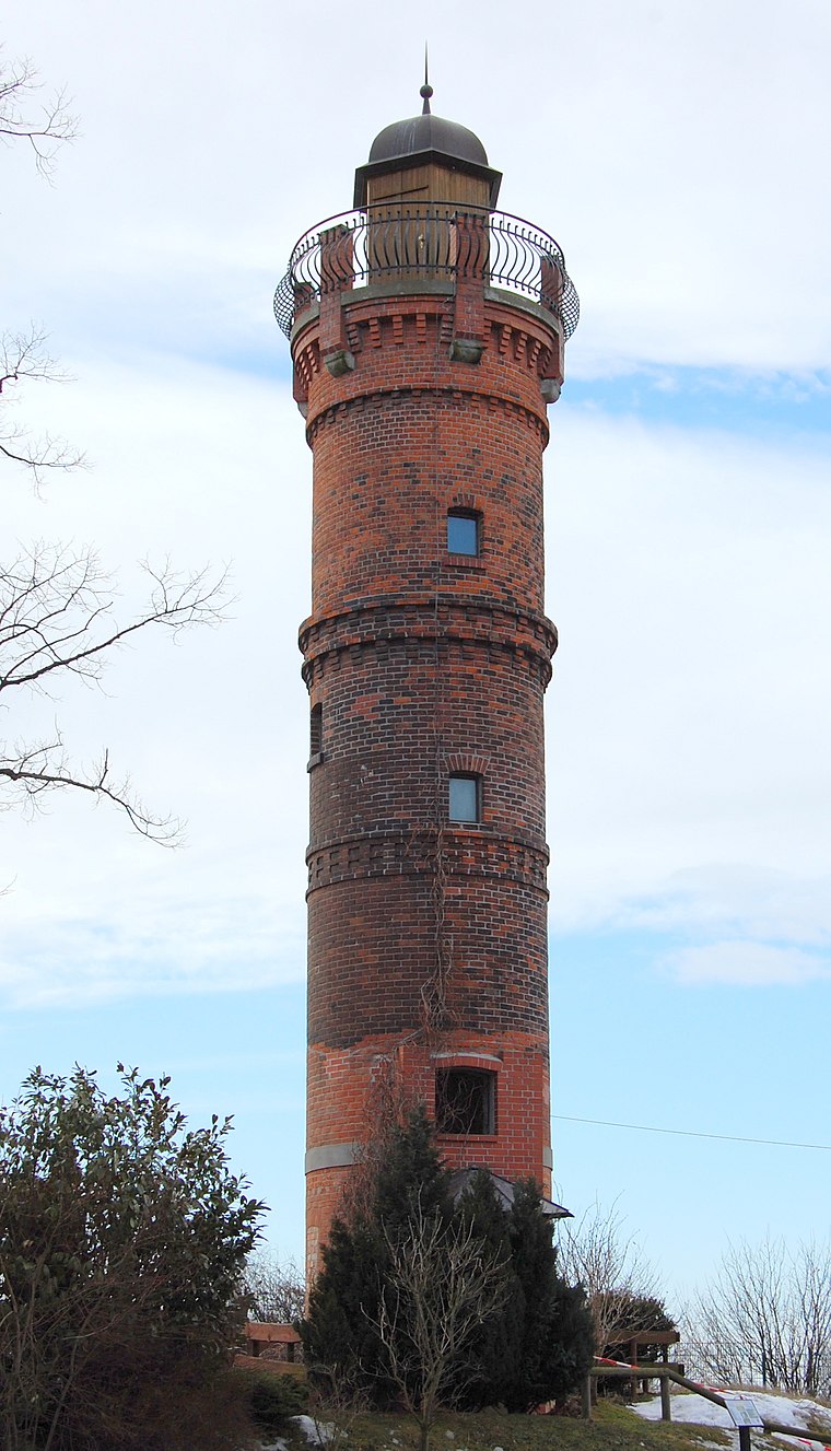
Photo: Olaf2, CC BY-SA 3.0.
Bismarck Tower is a scenic viewpoint, which is situated 3 km northeast of LPG Bördeland eG.
Bierer Berg
Peak
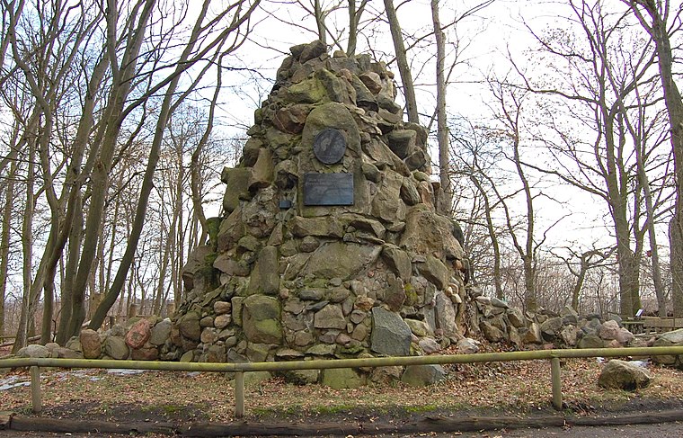
Photo: Olaf2, CC BY-SA 3.0.
Bierer Berg is a peak, which is situated 3 km northeast of LPG Bördeland eG.
St. Pankratius
Church
 St. Pankratius is a church, which is situated 3 km northwest of LPG Bördeland eG.
Places in the Area
Nearby places include Biere and Bad Salzelmen.
Biere
Village

Photo: Wolkenkratzer, CC BY-SA 4.0.
Biere is a former municipality in the district of Salzlandkreis, in Saxony-Anhalt, Germany. Since January 2008, it is part of the municipality Bördeland.
Bad Salzelmen
Suburb
Bad Salzelmen has been a district of Schönebeck since 1932 and is a state-approved spa in the Salzlandkreis in Saxony-Anhalt, Germany. It was founded in 1894 when the town of Groß Salze absorbed the neighbouring town of Elmen. Bad Salzelmen is situated 5 km northeast of LPG Bördeland eG.
Zens
Village
Zens is a former municipality in the district of Salzlandkreis, in Saxony-Anhalt, Germany. Since January 2008, it is part of the municipality Bördeland. Zens is situated 6 km southeast of LPG Bördeland eG.
LPG Bördeland eG
- Type: Farm
- Category: agriculture
- Location: Bördeland, Salzlandkreis, Saxony-Anhalt, Germany, Central Europe, Europe
- View on OpenStreetMap
Latitude
51.97855° or 51° 58′ 43″ northLongitude
11.65782° or 11° 39′ 28″ eastOpen location code
9F3HXMH5+C4OpenStreetMap ID
way 33744720OpenStreetMap feature
landuse=farmyard
This page is based on OpenStreetMap, Wikidata, and Wikimedia Commons.
We’d love your help improving our open data sources. Thank you for contributing.
Satellite Map
Discover LPG Bördeland eG from above in high-definition satellite imagery.
Notable Places Nearby
Highlights include Wasser-Rückhaltebecken and FSV Blau Weiß Biere.
Nearby Places
Explore places such as Lotto and Biere, Gewerbegebiet.
Saxony-Anhalt: Must-Visit Destinations
Delve into Magdeburg, Halle, Wittenberg, and Quedlinburg.
Curious Farms to Discover
Uncover intriguing farms from every corner of the globe.
About Mapcarta. Data © OpenStreetMap contributors and available under the Open Database License". Text is available under the CC BY-SA 4.0 license, except for photos, directions, and the map. Photo: GMM, Public domain.