Centre d’Atenció Primària de l’Eixample
Centre d’Atenció Primària de l’Eixample is a clinic in Lleida, Lleida, Catalonia. Centre d’Atenció Primària de l’Eixample is situated nearby to Plaça de Josep Boneu, as well as near the government office Delegació d’Economia i Hisenda de Lleida.| Tap on a place to explore it |
Places of Interest Nearby
Highlights include Centre d’Art la Panera and Església de Sant Martí.
Centre d’Art la Panera
Museum

Photo: Wikimedia, CC BY-SA 3.0.
The Centre d'Art la Panera is an art museum in Lleida, Catalonia, Spain. It's named after Carrer de la Panera, the street where it's located, in the old-town area known as Els Vins. Centre d’Art la Panera is situated 140 metres east of Centre d’Atenció Primària de l’Eixample.
Església de Sant Martí
Church
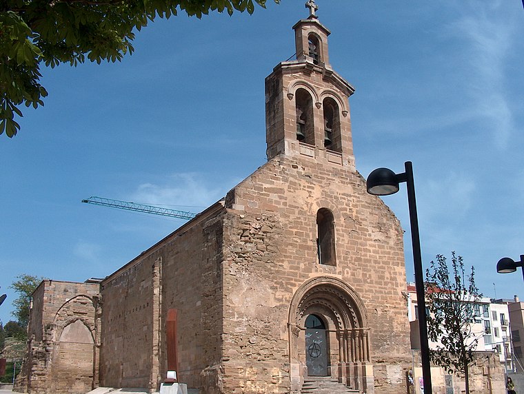
Photo: João Carvalho, CC BY-SA 2.5.
Església de Sant Martí is a church, which is situated 130 metres northeast of Centre d’Atenció Primària de l’Eixample.
Plaça dels Gramàtics
Square

Photo: AlbertRA, CC BY-SA 4.0.
Plaça dels Gramàtics is a square, which is situated 220 metres east of Centre d’Atenció Primària de l’Eixample.
Places in the Area
Nearby places include Universitat and Lleida Old Town.

Lleida Old Town
Neighborhood

Photo: Wikimedia, CC BY-SA 3.0.
Lleida Old Town is a district of Lleida, Catalonia, Spain. As of 2008 it had a population of 10,659 people.
Camp d’Esports
Neighborhood

Photo: Jabyer, CC BY-SA 4.0.
Camp d'Esports is a neighborhood in Lleida, Catalonia, Spain. As of 2009, it had 4,850 inhabitants. It is named after the Camp d'Esports football stadium located in the area and it is bordered by the neighborhoods of Príncep de Viana-Clot, Xalets-Humbert Torres, Universitat, Joc de la Bola and Ciutat Jardí-Les Valls.
Centre d’Atenció Primària de l’Eixample
- Type: Clinic
- Also known as: “CAP de l’Eixample” and “Hospital de la Creu Roja”
- Categories: health care and building
- Location: Lleida, Lleida, Catalonia, Eastern Spain, Spain, Iberia, Europe
- View on OpenStreetMap
Latitude
41.61718° or 41° 37′ 2″ northLongitude
0.6207° or 0° 37′ 15″ eastOpen location code
8FH2JJ8C+V7OpenStreetMap ID
way 337769475OpenStreetMap feature
amenity=clinicOpenStreetMap feature
building=yesOpenStreetMap feature
healthcare=clinic
This page is based on OpenStreetMap, Wikidata, and Wikimedia Commons.
We’d love your help improving our open data sources. Thank you for contributing.
Satellite Map
Discover Centre d’Atenció Primària de l’Eixample from above in high-definition satellite imagery.
Notable Places Nearby
Highlights include Plaça de Josep Boneu and Delegació d’Economia i Hisenda de Lleida.
Nearby Places
Explore places such as Servei Tècnic de Punt de Trobada and Natur House.
Lleida: Must-Visit Destinations
Delve into Val d’Aran, La Seu d’Urgell, Aigüestortes i Estany de Sant Maurici National Park, and Cervera.
Curious Clinics to Discover
Uncover intriguing clinics from every corner of the globe.
About Mapcarta. Data © OpenStreetMap contributors and available under the Open Database License". Text is available under the CC BY-SA 4.0 license, except for photos, directions, and the map. Photo: BREIT, CC BY-SA 3.0.