Aussichtsplattform Kendlmühlfilzen
Aussichtsplattform Kendlmühlfilzen is a scenic viewpoint in Bavaria, Germany. Aussichtsplattform Kendlmühlfilzen is situated nearby to the village Grassau, as well as near Rottau.| Tap on a place to explore it |
Places of Interest Nearby
Highlights include St. Peter und Paul and St. Margaretha.
St. Peter und Paul
Church

Photo: Rollroboter, CC BY-SA 3.0.
St. Peter und Paul is a church, which is situated 1½ km northeast of Aussichtsplattform Kendlmühlfilzen.
St. Margaretha
Church

Photo: Trd43, CC BY-SA 4.0.
St. Margaretha is a church, which is situated 2 km east of Aussichtsplattform Kendlmühlfilzen.
Mariä Himmelfahrt
Church
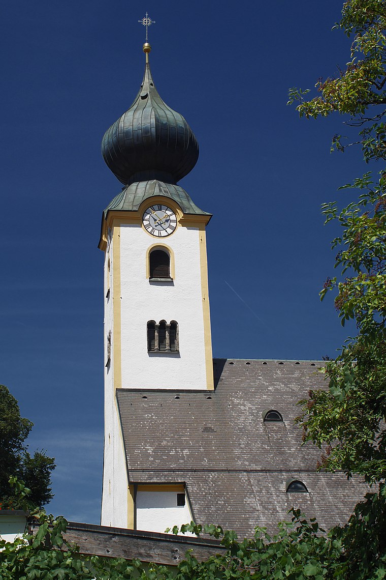
Photo: Thcilnegeg, CC BY-SA 4.0.
Mariä Himmelfahrt is a church, which is situated 2 km south of Aussichtsplattform Kendlmühlfilzen.
Places in the Area
Nearby places include Grassau and Rottau.
Grassau
Village

Photo: Wikimedia, CC BY-SA 3.0.
Grassau is a market town in the district of Traunstein in Bavaria in Germany. It is located south of lake Chiemsee in the valley of the Tiroler Ache.
Rottau
Village

Photo: Pixelteufel, CC BY 2.0.
Rottau is a village, which is situated 2½ km west of Aussichtsplattform Kendlmühlfilzen.
Übersee
Village
 Übersee is a municipality and a village in the rural district of Traunstein in upper Bavaria, Germany. It lies on the south shore of lake Chiemsee. Übersee is situated 3½ km northeast of Aussichtsplattform Kendlmühlfilzen.
Aussichtsplattform Kendlmühlfilzen
- Type: Scenic viewpoint
- Wheelchair access: no
- Categories: tower, building, and tourism
- Location: Bavaria, Germany, Central Europe, Europe
- View on OpenStreetMap
Latitude
47.7988° or 47° 47′ 56″ northLongitude
12.44776° or 12° 26′ 52″ eastOpen location code
8FVJQCXX+G4OpenStreetMap ID
way 338514954OpenStreetMap feature
building=yesOpenStreetMap feature
man_made=towerOpenStreetMap feature
tourism=viewpointOpenStreetMap attribute
wheelchair=no
This page is based on OpenStreetMap, Wikidata, and Wikimedia Commons.
We’d love your help improving our open data sources. Thank you for contributing.
Satellite Map
Discover Aussichtsplattform Kendlmühlfilzen from above in high-definition satellite imagery.
Notable Places Nearby
Highlights include Kendlmühl-Filz and Clubhaus Golffreunde Achental.
Nearby Places
Explore places such as Naturschutzgebiet Kendlmühlfilzen and Eisenbahn im Moor?.
Bavaria: Must-Visit Destinations
Delve into Munich, Nuremberg, Erlangen, and Augsburg.
Curious Scenic Viewpoints to Discover
Uncover intriguing scenic viewpoints from every corner of the globe.
About Mapcarta. Data © OpenStreetMap contributors and available under the Open Database License". Text is available under the CC BY-SA 4.0 license, except for photos, directions, and the map. Photo: gravitat-OFF, CC BY 2.0.