Policía Local
Policía Local is a police station in Bellavista-La Palmera, Seville, Andalusia. Policía Local is situated nearby to the library Biblioteca municipal Luis Cernuda, as well as near the public building Centro Cívico Bellavista.| Tap on a place to explore it |
Places of Interest Nearby
Highlights include Estadio Benito Villamarín and Lagoh shopping mall.
Estadio Benito Villamarín
Stadium
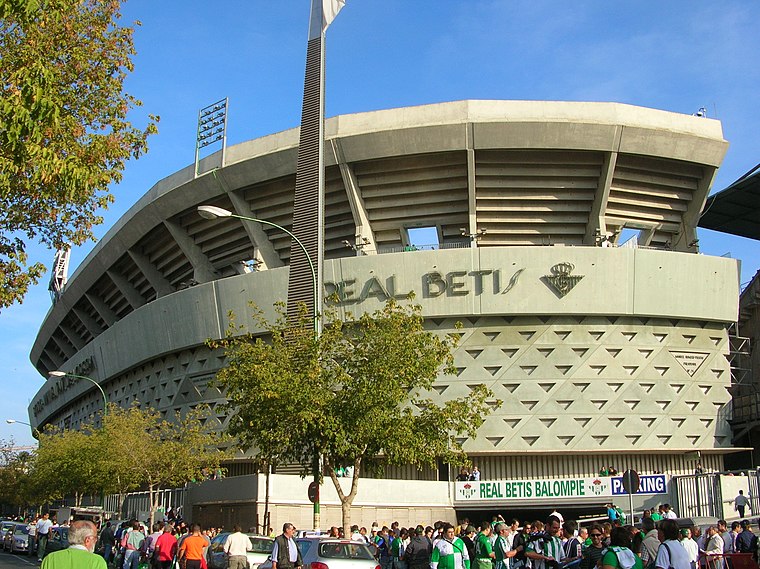 Estadio Benito Villamarín is a stadium in Sevilla, Spain, and the home of Real Betis since its completion in 1929. It has a capacity of 60,721. Estadio Benito Villamarín is situated 3½ km north of Policía Local.
Lagoh shopping mall
Shopping center

Photo: CarlosVdeHabsburgo, CC BY-SA 4.0.
Lagoh shopping mall is a shopping center, which is situated 2½ km northwest of Policía Local.
Centenario Bridge
Bridge

Photo: Wikimedia, CC BY-SA 3.0.
The Centenario Bridge is a cable-stayed bridge in Seville, Spain. It crosses over the left branch of Guadalquivir. Centenario Bridge is situated 4 km northwest of Policía Local.
Places in the Area
Nearby places include Bellavista and Los Bermejales.
Bellavista
Neighborhood
Bellavista is a neighbourhood in the Bellavista-La Palmera district in the south of the city of Seville, Andalusia, Spain. It lies on the east bank of the Guadaira river, a tributary of the Guadalquivir.
Los Bermejales
Neighborhood

Photo: CarlosVdeHabsburgo, CC BY-SA 3.0.
Los Bermejales is a neighborhood, which is situated 2½ km northwest of Policía Local.
Quinto
Neighborhood

Photo: Germany444, CC BY-SA 4.0.
Quinto is a neighborhood, which is situated 3½ km northeast of Policía Local.
Policía Local
- Type: Police station
- Also known as: “Policía Local de Bellavista”
- Category: building
- Location: Bellavista-La Palmera, Seville, Seville, Andalusia, Spain, Iberia, Europe
- View on OpenStreetMap
Latitude
37.32564° or 37° 19′ 32″ northLongitude
-5.96567° or 5° 57′ 56″ westOperator
Municipal policeOpen location code
8C9P82GM+7POpenStreetMap ID
way 339537260OpenStreetMap feature
amenity=policeOpenStreetMap feature
building=yes
This page is based on OpenStreetMap, Wikidata, and Wikimedia Commons.
We’d love your help improving our open data sources. Thank you for contributing.
Satellite Map
Discover Policía Local from above in high-definition satellite imagery.
Places with the Same Name
Discover other places named “Policía Local”.
Notable Places Nearby
Highlights include Biblioteca municipal Luis Cernuda and Centro Cívico Bellavista.
Nearby Places
Explore places such as Farmacia Santa Ángela (Bellavista) and Cadena 88.
Curious Police Stations to Discover
Uncover intriguing police stations from every corner of the globe.
About Mapcarta. Data © OpenStreetMap contributors and available under the Open Database License". Text is available under the CC BY-SA 4.0 license, except for photos, directions, and the map. Photo: Wikimedia, CC BY-SA 4.0.