Centre d’incendie et de secours de Ligny-le-Ribault
Centre d’incendie et de secours de Ligny-le-Ribault is a fire station in Ligny-le-Ribault, Arrondissement of Orléans, Centre-Val de Loire. Centre d’incendie et de secours de Ligny-le-Ribault is situated nearby to Town hall of Ligny-le-Ribault, as well as near the garden Place du 11-Novembre.| Tap on a place to explore it |
Places of Interest Nearby
Highlights include Église Saint-Martin de Ligny-le-Ribault and Château de Bon-Hôtel.
Église Saint-Martin de Ligny-le-Ribault
Church
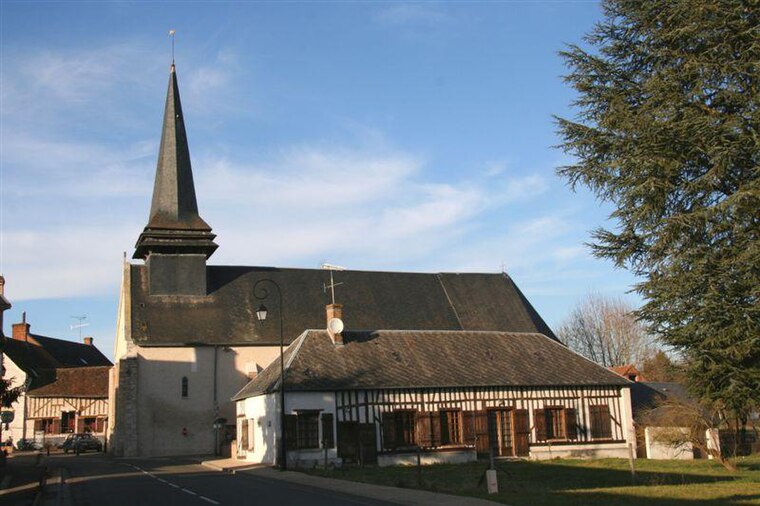
Photo: Vincent4145, CC BY-SA 3.0.
Église Saint-Martin de Ligny-le-Ribault is a church, which is situated 360 metres northeast of Centre d’incendie et de secours de Ligny-le-Ribault.
Château de Bon-Hôtel
Castle

Photo: Raphaël Le Breton, CC BY-SA 4.0.
The Château de Bon-Hôtel is a château of the 19th century, located in Ligny-le-Ribault, in Loiret in the region of Centre-Val de Loire. Château de Bon-Hôtel is situated 2 km west of Centre d’incendie et de secours de Ligny-le-Ribault.
Places in the Area
Nearby places include Villeny and Jouy-le-Potier.
Villeny
Village

Photo: Vincent4145, CC BY-SA 3.0.
Villeny is a commune in the Loir-et-Cher department in central France. Villeny is situated 7 km south of Centre d’incendie et de secours de Ligny-le-Ribault.
Jouy-le-Potier
Village

Photo: Wikimedia, Public domain.
Jouy-le-Potier is a commune in the Loiret department in north-central France. Jouy-le-Potier is situated 8 km north of Centre d’incendie et de secours de Ligny-le-Ribault.
Centre d’incendie et de secours de Ligny-le-Ribault
- Type: Fire station
- Also known as: “CPI Ligny-le-Ribault”
- Category: building
- Location: Ligny-le-Ribault, Arrondissement of Orléans, Loiret, Centre-Val de Loire, France, Europe
- View on OpenStreetMap
Latitude
47.68216° or 47° 40′ 56″ northLongitude
1.77884° or 1° 46′ 44″ eastOperator
SDIS 45Open location code
8FV3MQJH+VGOpenStreetMap ID
way 340333875OpenStreetMap feature
amenity=fire_stationOpenStreetMap feature
building=fire_station
This page is based on OpenStreetMap, Wikidata, and Wikimedia Commons.
We’d love your help improving our open data sources. Thank you for contributing.
Satellite Map
Discover Centre d’incendie et de secours de Ligny-le-Ribault from above in high-definition satellite imagery.
Notable Places Nearby
Highlights include Town hall of Ligny-le-Ribault and Place du 11-Novembre.
Nearby Places
Explore places such as Gite d’Etape Ligny-le-Ribault and Boulangerie Pâtisserie Kima.
Centre-Val de Loire: Must-Visit Destinations
Delve into Orléans, Tours, Chartres, and Bourges.
Curious Fire Stations to Discover
Uncover intriguing fire stations from every corner of the globe.
About Mapcarta. Data © OpenStreetMap contributors and available under the Open Database License". Text is available under the CC BY-SA 4.0 license, except for photos, directions, and the map. Photo: PMRMaeyaert, CC BY-SA 3.0.