Luckengrabenalm
Luckengrabenalm is a building in Kreuth, Miesbach, Bavaria. Luckengrabenalm is situated nearby to the peak Bettstein, as well as near the ruins Kamp-Alpe (verfallen).| Tap on a place to explore it |
Places of Interest Nearby
Highlights include Bettstein and Hirschberg.

Hirschberg
Peak

Photo: Wikimedia, CC BY-SA 3.0.
The Hirschberg is a 1,670-metre-high mountain in the Bavarian Fore-alps south of Lake Tegernsee. The summit may be reached via a gentle mountain path either from Scharling, Kreuth or Bad Wiessee, all three routes being classified as not difficult.
Hirschberghaus
Mountain hut

Photo: Rufus46, CC BY-SA 3.0.
Hirschberghaus is a mountain hut, which is situated 1½ km east of Luckengrabenalm.
Places in the Area
Nearby places include Sonnbergalm Hochleger and Bad Wiessee.
Sonnbergalm Hochleger
Locality

Photo: Wasquewhat, CC BY-SA 4.0.
Sonnbergalm Hochleger is a locality, which is situated 4 km south of Luckengrabenalm.
Bad Wiessee
Village
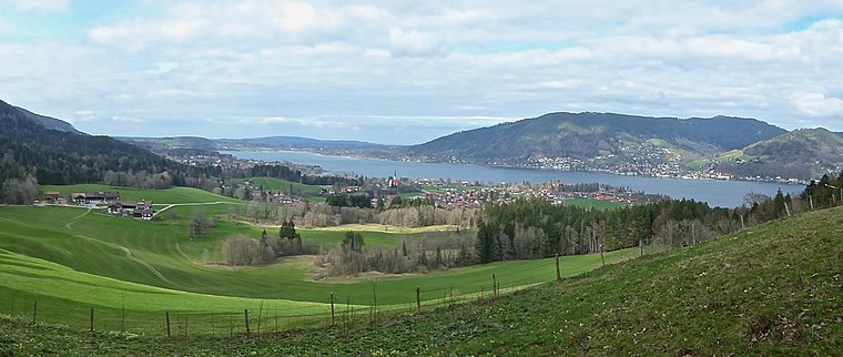
Photo: Ventus55, CC BY-SA 4.0.
Bad Wiessee is a municipality in the district of Miesbach in Upper Bavaria in Germany. Since 1922, it has been a spa town and located on the western shore of the Tegernsee Lake. Bad Wiessee is situated 6 km northeast of Luckengrabenalm.
Wildbad Kreuth
Hamlet

Photo: W. Bulach, CC BY-SA 4.0.
Wildbad Kreuth is a hamlet, which is situated 7 km southeast of Luckengrabenalm.
Luckengrabenalm
- Type: Building
- Location: Kreuth, Miesbach, Upper Bavaria, Bavaria, Germany, Central Europe, Europe
- View on OpenStreetMap
Latitude
47.6656° or 47° 39′ 56″ northLongitude
11.68326° or 11° 40′ 60″ eastOperator
privatOpen location code
8FVHMM8M+68OpenStreetMap ID
way 34397723OpenStreetMap feature
building=yes
This page is based on OpenStreetMap, Wikidata, and Wikimedia Commons.
We’d love your help improving our open data sources. Thank you for contributing.
Satellite Map
Discover Luckengrabenalm from above in high-definition satellite imagery.
Notable Places Nearby
Highlights include Kamp-Alpe (verfallen) and Bettsteineck.
Nearby Places
Explore places such as Raffelgraben JH and Holzstube.
Upper Bavaria: Must-Visit Destinations
Delve into Munich, Ingolstadt, Dachau, and Rosenheim.
Curious Buildings to Discover
Uncover intriguing buildings from every corner of the globe.
About Mapcarta. Data © OpenStreetMap contributors and available under the Open Database License". Text is available under the CC BY-SA 4.0 license, except for photos, directions, and the map. Photo: Ricardalovesmonuments, CC BY-SA 4.0.