Elektro Lillich
Elektro Lillich is an industrial building in Ludwigsburg, Stuttgart, Baden-Württemberg which is located on Zeppelinstraße. Elektro Lillich is situated nearby to the dog park Verein der Hundefreunde Ludwigsburg u.U. e.V., as well as near Gelände ehemaliges US-Tanklager (Osterholz Storage).| Tap on a place to explore it |
Places of Interest Nearby
Highlights include Asperg station and Hohenasperg.
Asperg station
Railway station

Photo: Giftzwerg 88, CC BY-SA 3.0.
Asperg station is a station on the network of the Stuttgart S-Bahn in the German state of Baden-Württemberg, located at the 17.6 kilometre mark of the Franconia Railway. Asperg station is situated 1 km northwest of Elektro Lillich.
Hohenasperg

Photo: Carsten Steger, CC BY-SA 4.0.
Hohenasperg, located in the federal state of Baden-Württemberg near Stuttgart, Germany, of which it is administratively part, is an ancient fortress and prison overlooking the town of Asperg. Hohenasperg is situated 2 km northwest of Elektro Lillich.
St. Katharina
Church
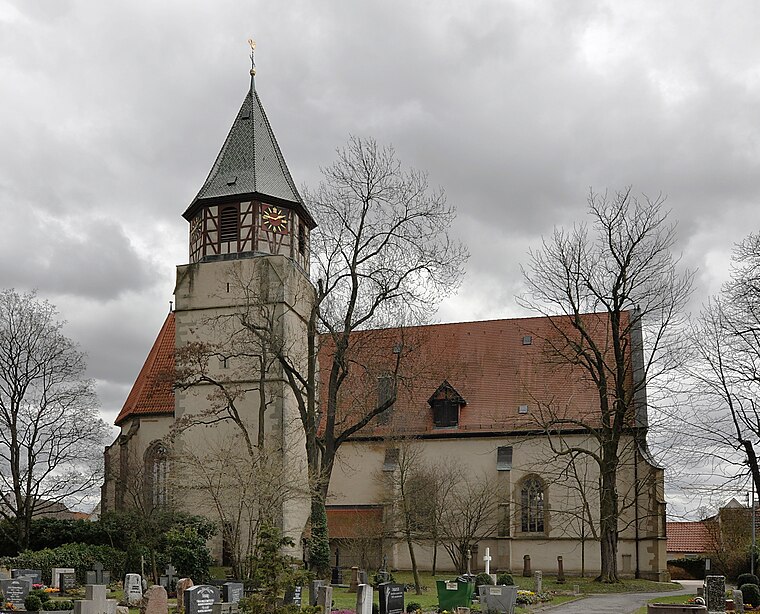
Photo: Wikimedia, CC BY-SA 3.0.
St. Katharina is a church, which is situated 1¼ km northeast of Elektro Lillich.
Places in the Area
Nearby places include Eglosheim and Asperg.

Asperg
Town

Photo: Schmelzle, CC BY-SA 3.0.
Asperg is a town in the district of Ludwigsburg, Baden-Württemberg, Germany.
Möglingen
Village

Photo: Mussklprozz, CC BY-SA 3.0.
Möglingen is a municipality in the district of Ludwigsburg, Baden-Württemberg, Germany. It is situated 13 km northwest of Stuttgart, and 5 km west of Ludwigsburg. Möglingen has the headquarter of the "Württemberger Weingärtner-Zentralgenossenschaft"… Möglingen is situated 2½ km southwest of Elektro Lillich.
Elektro Lillich
- Type: Industrial building
- Address: Zeppelinstraße 5, Asperg, 71679
- Categories: building and industry
- Location: Ludwigsburg, Ludwigsburg, Stuttgart, Stuttgart Region, Baden-Württemberg, Germany, Central Europe, Europe
- View on OpenStreetMap
Latitude
48.89988° or 48° 53′ 60″ northLongitude
9.15671° or 9° 9′ 24″ eastOperator
Elektro Lillich GmbHOpen location code
8FWFV5X4+XMOpenStreetMap ID
way 344891586OpenStreetMap feature
building=industrial
This page is based on OpenStreetMap, Wikidata, and Wikimedia Commons.
We’d love your help improving our open data sources. Thank you for contributing.
Satellite Map
Discover Elektro Lillich from above in high-definition satellite imagery.
Notable Places Nearby
Highlights include Verein der Hundefreunde Ludwigsburg u.U. e.V. and Gelände ehemaliges US-Tanklager (Osterholz Storage).
Nearby Places
Explore places such as ske Haftetiketten and Lack & Karosserie Reit GmbH.
Stuttgart Region: Must-Visit Destinations
Delve into Stuttgart, Esslingen, Sindelfingen, and Waiblingen.
Curious Industrial Buildings to Discover
Uncover intriguing industrial buildings from every corner of the globe.
About Mapcarta. Data © OpenStreetMap contributors and available under the Open Database License". Text is available under the CC BY-SA 4.0 license, except for photos, directions, and the map. Photo: Traveler100, CC BY-SA 3.0.