Hof Bostel
Hof Bostel is a farm in Walsrode, Heidekreis, Lower Saxony. Hof Bostel is situated nearby to the village Benzen, as well as near the forest Lehmkuhle.| Tap on a place to explore it |
Places of Interest Nearby
Highlights include Ruensteen Walsrode and Bismarck memorial.
Ruensteen Walsrode
Stone
 Ruensteen Walsrode is a stone, which is situated 1¼ km northwest of Hof Bostel.

Stadtkirche
Church
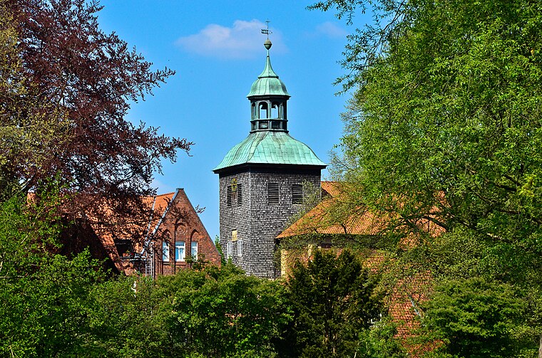
Photo: Fiorellino, CC BY-SA 3.0.
Stadtkirche is a church, which is situated 3 km north of Hof Bostel.
Places in the Area
Nearby places include Benzen and Düshorn.
Benzen
Village
Benzen is a village and Ortschaft in the town of Walsrode in the Heidekreis district, Lower Saxony, north Germany.
Düshorn
Village

Photo: Losch, CC BY-SA 3.0.
Düshorn is a village, which is situated 3½ km east of Hof Bostel.
Altenboitzen
Village
Altenboitzen is a village and today a village within the borough of Walsrode in Heidekreis district in the German state of Lower Saxony. Formerly an independent municipality, it is part of Walsrode since 1974. Altenboitzen is situated 5 km southwest of Hof Bostel.
Hof Bostel
- Type: Farm
- Category: agriculture
- Location: Walsrode, Heidekreis, Lüneburg Heath, Lower Saxony, Germany, Central Europe, Europe
- View on OpenStreetMap
Latitude
52.83388° or 52° 50′ 2″ northLongitude
9.58181° or 9° 34′ 55″ eastOpen location code
9F4FRHMJ+HPOpenStreetMap ID
way 353774196OpenStreetMap feature
landuse=farmyard
This page is based on OpenStreetMap, Wikidata, and Wikimedia Commons.
We’d love your help improving our open data sources. Thank you for contributing.
Satellite Map
Discover Hof Bostel from above in high-definition satellite imagery.
Notable Places Nearby
Highlights include Freiwillige Feuerwehr Benzen and Benzen.
Nearby Places
Explore places such as Spargelhof Bostel and Hof Rengstorf.
Lüneburg Heath: Must-Visit Destinations
Delve into Lüneburg, Celle, Gifhorn, and Soltau.
Curious Farms to Discover
Uncover intriguing farms from every corner of the globe.
About Mapcarta. Data © OpenStreetMap contributors and available under the Open Database License". Text is available under the CC BY-SA 4.0 license, except for photos, directions, and the map. Photo: Fiorellino, CC BY-SA 3.0.