P + R Bahnhof Rednitzhembach
P + R Bahnhof Rednitzhembach is a parking area in Rednitzhembach, Roth, Bavaria. P + R Bahnhof Rednitzhembach is situated nearby to the post office Postlaube Rednitzhembach, as well as near the church Marienkreuz Schönstatt Gemeinschaft.| Tap on a place to explore it |
- Type: Parking area
- Parking: surface
- Wheelchair access: yes
Places of Interest Nearby
Highlights include Metzgerkreuz bei Rednitzhembach and Schwabach.
Metzgerkreuz bei Rednitzhembach
Stone
 Metzgerkreuz bei Rednitzhembach is a stone, which is situated 1½ km southeast of P + R Bahnhof Rednitzhembach.
Schwabach
Railway station
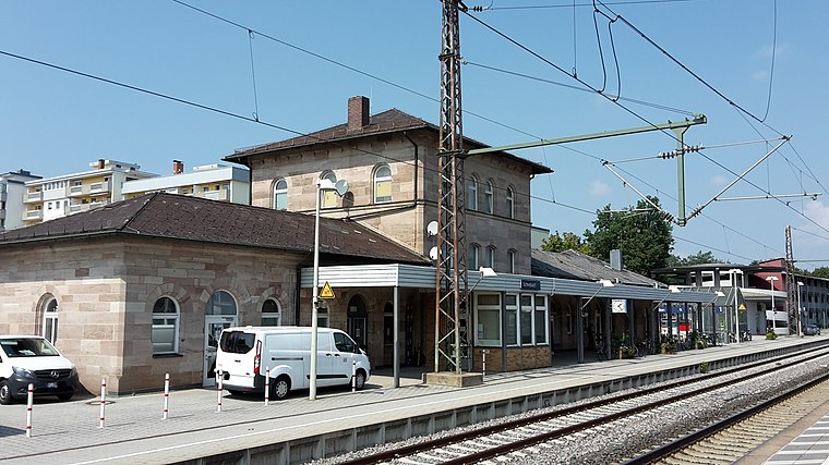
Photo: Dealerofsalvation, CC BY-SA 4.0.
Schwabach station is a railway station in the municipality of Schwabach, located in Middle Franconia, Germany. The station is on the Nuremberg–Augsburg and Nuremberg–Roth lines of Deutsche Bahn. Schwabach is situated 3½ km northwest of P + R Bahnhof Rednitzhembach.
Steinkreuz nördlich von Pfaffenhofen
Stone

Photo: Derzno, CC BY-SA 4.0.
Steinkreuz nördlich von Pfaffenhofen is a stone, which is situated 3 km south of P + R Bahnhof Rednitzhembach.
Places in the Area
Nearby places include Igelsdorf and Ottersdorf.


Schwarzach bei Schwabach
Hamlet

Photo: Siegmar S., CC BY-SA 3.0.
Schwarzach bei Schwabach is a hamlet, which is situated 3 km north of P + R Bahnhof Rednitzhembach.
P + R Bahnhof Rednitzhembach
- Category: transportation
- Location: Rednitzhembach, Roth, Middle Franconia, Franconia, Bavaria, Germany, Central Europe, Europe
- View on OpenStreetMap
Latitude
49.30367° or 49° 18′ 13″ northLongitude
11.06446° or 11° 3′ 52″ eastOpen location code
8FXH8337+FQOpenStreetMap ID
way 353803063OpenStreetMap feature
amenity=parkingOpenStreetMap attribute
parking=surfaceOpenStreetMap attribute
wheelchair=yes
This page is based on OpenStreetMap, Wikidata, and Wikimedia Commons.
We’d love your help improving our open data sources. Thank you for contributing.
Satellite Map
Discover P + R Bahnhof Rednitzhembach from above in high-definition satellite imagery.
Notable Places Nearby
Highlights include Rednitzhembach and Postlaube Rednitzhembach.
Nearby Places
Explore places such as Rednitzhembach and Semen Lunae.
Middle Franconia: Must-Visit Destinations
Delve into Nuremberg, Erlangen, Fürth, and Ansbach.
Curious Parking Areas to Discover
Uncover intriguing parking areas from every corner of the globe.
About Mapcarta. Data © OpenStreetMap contributors and available under the Open Database License". Text is available under the CC BY-SA 4.0 license, except for photos, directions, and the map. Photo: Berthold Werner, CC0.