Praça do Redentor
Praça do Redentor is a square in Curitiba, Grande Curitiba, Paraná which is located on Rua Desembargador Benvindo Valente. Praça do Redentor is situated nearby to the park Praça Padre João Sotto Maior, as well as near the cemetery Cemitério Municipal São Francisco de Paula.| Tap on a place to explore it |
- Type: Square
- Also known as: “Praça do Gaúcho”
- Address: 60 Rua Desembargador Benvindo Valente
Places of Interest Nearby
Highlights include Estádio Couto Pereira and Holocaust Museum in Curitiba.
Estádio Couto Pereira
Stadium
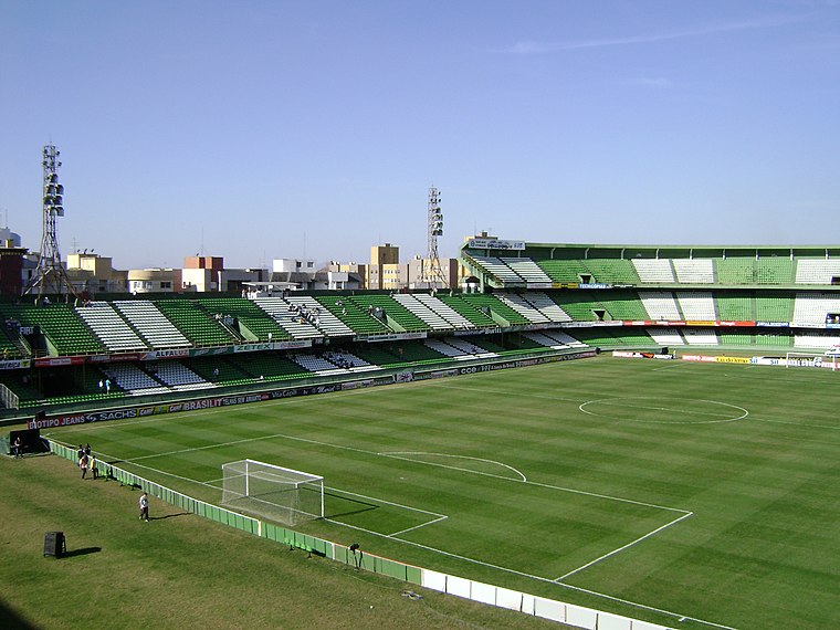
Photo: Kevinklop, CC BY-SA 3.0.
Estádio Major Antônio Couto Pereira, often shortened to Couto Pereira, is the home of Coritiba Foot Ball Club, located in Curitiba, Paraná state, Brazil. Estádio Couto Pereira is situated 1½ km east of Praça do Redentor.
Holocaust Museum in Curitiba
Museum
The Holocaust Museum in Curitiba is a museum situated in the city of Curitiba, capital of the Brazilian state of Paraná. It was the first of that theme in Brazil, aiming to keep alive the memory of the Holocaust through the memory of its victims and its survivors. Holocaust Museum in Curitiba is situated 670 metres northeast of Praça do Redentor.
Shopping Mueller
Shopping center
 Shopping Mueller is a shopping center, which is situated 530 metres southeast of Praça do Redentor.
Places in the Area
Nearby places include Curitiba Historical Centre and Civic Center.
Curitiba Historical Centre
Neighborhood

Photo: KikoCorreia, CC BY-SA 2.5 br.
Curitiba Historical Centre is a neighborhood.
Civic Center
Suburb
Photo: Cassia Naomi Nakai, CC BY-SA 4.0.
Curitiba is the capital and largest city in the state of Paraná in Southern Brazil. The city's population was 1,829,225 as of 2024, making it the eighth most populous city in Brazil and the largest in Brazil's South Region.
Pinhais

Photo: KikoCorreia, CC BY 3.0.
Pinhais is a municipality in Paraná state in Brazil. As of 2020, the population was 133,490. It was emancipated from the municipality of Piraquara in 1992 and is part of the Metropolitan region of Curitiba. It is the smallest municipality in Paraná by area.
Praça do Redentor
- Categories: pedestrian zone and locality
- Location: Curitiba, Grande Curitiba, Paraná, South, Brazil, South America
- View on OpenStreetMap
Latitude
-25.42079° or 25° 25′ 15″ southLongitude
-49.27491° or 49° 16′ 30″ westOpen location code
586GHPHG+M2OpenStreetMap ID
way 353816445OpenStreetMap feature
highway=pedestrianOpenStreetMap feature
place=square
This page is based on OpenStreetMap, Wikidata, and Wikimedia Commons.
We’d love your help improving our open data sources. Thank you for contributing.
Satellite Map
Discover Praça do Redentor from above in high-definition satellite imagery.
Notable Places Nearby
Highlights include Praça Padre João Sotto Maior and Cemitério Municipal São Francisco de Paula.
Nearby Places
Explore places such as Sorveteria do Gaúcho and Bar da Banca.
Grande Curitiba: Must-Visit Destinations
Delve into Colombo, Pinhais, Campo Largo, and Mandirituba.
Curious Squares to Discover
Uncover intriguing squares from every corner of the globe.
About Mapcarta. Data © OpenStreetMap contributors and available under the Open Database License". Text is available under the CC BY-SA 4.0 license, except for photos, directions, and the map. Photo: Squibb, CC BY 2.5.