Colegio Doña Mayor
Colegio Doña Mayor is a school in Burlada/Burlata, Navarre which is located on Plaza Almiradío de Navascués. Colegio Doña Mayor is situated nearby to the square Nabaskozeko Almiradioko enparantza / Plaza Almiradío de Navascués, as well as near the reservoir Depósito de la Txantrea.| Tap on a place to explore it |
- Type: School
- Also known as: “Colegio Público de Educación Infantil y Primaria Doña Mayor Haur eta Lehen Hezkuntzako Ikastetxe Publikoa” and “CPEIP Doña Mayor HLHIP”
- Address: Plaza Almiradío de Navascués 3, 31015
Places of Interest Nearby
Highlights include Villava/Atarrabia town hall and Laboratorio Agroquímico de Navarra.
Villava/Atarrabia town hall
Town hall
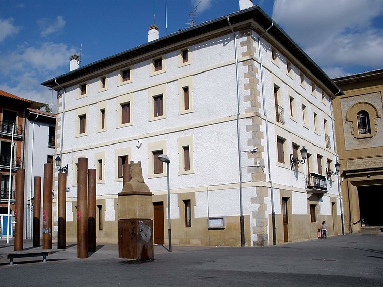 Villava/Atarrabia town hall is situated 2 km east of Colegio Doña Mayor.
Laboratorio Agroquímico de Navarra
Public building

Photo: Zarateman, CC BY-SA 3.0.
Laboratorio Agroquímico de Navarra is a public building, which is situated 1½ km southeast of Colegio Doña Mayor.
Villava Fulling Mill
Museum

Photo: Jialxv, CC BY-SA 4.0.
Villava Fulling Mill is a museum, which is situated 2 km east of Colegio Doña Mayor.
Places in the Area
Nearby places include Ansoáin – Antsoain and Azotz/Azoz.
Ansoáin – Antsoain
Town
 Ansoain is a town and municipality located in the province and autonomous community of Navarra, northern Spain.


Colegio Doña Mayor
- Category: education
- Location: Burlada/Burlata, Navarre, Northern Spain, Spain, Iberia, Europe
- View on OpenStreetMap
Latitude
42.83599° or 42° 50′ 10″ northLongitude
-1.62819° or 1° 37′ 42″ westOpen location code
8CJWR9PC+9POpenStreetMap ID
way 357016483OpenStreetMap feature
amenity=school
This page is based on OpenStreetMap, Wikidata, and Wikimedia Commons.
We’d love your help improving our open data sources. Thank you for contributing.
Satellite Map
Discover Colegio Doña Mayor from above in high-definition satellite imagery.
Notable Places Nearby
Highlights include Nabaskozeko Almiradioko enparantza / Plaza Almiradío de Navascués and Depósito de la Txantrea.
Nearby Places
Explore places such as Carrefour Express and Tamaran.
Navarre: Must-Visit Destinations
Delve into Pamplona, Roncesvalles, and Uterga.
Curious Schools to Discover
Uncover intriguing schools from every corner of the globe.
About Mapcarta. Data © OpenStreetMap contributors and available under the Open Database License". Text is available under the CC BY-SA 4.0 license, except for photos, directions, and the map. Photo: Artsuaga, CC BY-SA 3.0.