Alten- und Pflegezentrum St. Anna
Alten- und Pflegezentrum St. Anna is a social service facility in Karlsruhe, Rhine-Neckar, Baden-Württemberg which is located on Rüppurrer Straße. Alten- und Pflegezentrum St. Anna is situated nearby to the tram stop Karlsruhe Werderstraße, as well as near the playground Semmy.| Tap on a place to explore it |
- Type: Social service facility
- Denomination: Roman Catholic
- Address: Rüppurrer Straße 29, Karlsruhe, 76137
- Wheelchair access: yes
Places of Interest Nearby
Highlights include Verkehrsmuseum Karlsruhe and Karlsruhe Zoo.
Verkehrsmuseum Karlsruhe
Museum

Photo: Klaus Nahr, CC BY-SA 2.0.
Verkehrsmuseum Karlsruhe is situated 240 metres northwest of Alten- und Pflegezentrum St. Anna.
Karlsruhe Zoo
Park
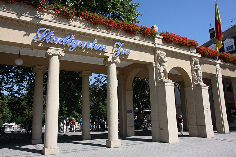
Photo: Root66, CC BY-SA 3.0.
The Karlsruhe Zoo is a city garden with a zoo in the southwest of Karlsruhe, Germany. It also encompasses the outer area; Tierpark Oberwald in the southeast of the city. Karlsruhe Zoo is situated 800 metres west of Alten- und Pflegezentrum St. Anna.
Unsere Liebe Frau
Church

Photo: Zinnmann, CC BY-SA 3.0 de.
Unsere Liebe Frau is a church, which is situated 280 metres southwest of Alten- und Pflegezentrum St. Anna.
Places in the Area
Nearby places include Mühlburg and Wolfartsweier.
Mühlburg
Suburb

Photo: Baden-Paul, CC0.
Mühlburg is a district of Karlsruhe, Germany. The district is further divided into Alt-Mühlburg, Weingärtensiedlung, Rheinhafen and Mühlburger Feld. Mühlburg is situated 4 km west of Alten- und Pflegezentrum St. Anna.
Wolfartsweier
Suburb
Wolfartsweier is a village and a quarter of Karlsruhe, Baden-Württemberg, Germany. Its population is 3,068. It was first mentioned in 1261 AD under the name of "Wolvoldeswilere". Wolfartsweier is situated 4 km southeast of Alten- und Pflegezentrum St. Anna.
Durlach
Suburb

Photo: Martin-D1, Public domain.
Durlach is a district in Karlsruhe, Germany, with a population of roughly 30,000. The district is further divided into Alt-Durlach, Dornwald-Untermühl, Hanggebiet, Bergwald, Aue, Lohn-Lissen and Killisfeld. Durlach is situated 4½ km east of Alten- und Pflegezentrum St. Anna.
Alten- und Pflegezentrum St. Anna
Latitude
49.00045° or 49° 0′ 2″ northLongitude
8.41138° or 8° 24′ 41″ eastInception
2005Operator
Orden der Barmherzigen Schwestern vom heiligen Vinzenz von PaulOpen location code
8FXC2C26+5HOpenStreetMap ID
way 357264951OpenStreetMap feature
amenity=social_facilityOpenStreetMap attribute
denomination=roman_catholicOpenStreetMap attribute
wheelchair=yes
This page is based on OpenStreetMap, Wikidata, and Wikimedia Commons.
We’d love your help improving our open data sources. Thank you for contributing.
Satellite Map
Discover Alten- und Pflegezentrum St. Anna from above in high-definition satellite imagery.
Notable Places Nearby
Highlights include Karlsruhe Werderstraße and Semmy.
Nearby Places
Explore places such as Fahrplan and Werderstraße.
Rhine-Neckar: Must-Visit Destinations
Delve into Heidelberg, Mannheim, Heilbronn, and Sinsheim.
Curious Social Service Facilities to Discover
Uncover intriguing social service facilities from every corner of the globe.
About Mapcarta. Data © OpenStreetMap contributors and available under the Open Database License". Text is available under the CC BY-SA 4.0 license, except for photos, directions, and the map. Photo: Ruhrfisch, CC BY-SA 3.0.