Keidel-Ranch Ponyhof Behrenbruch
Keidel-Ranch Ponyhof Behrenbruch is a farm in Schönefeld, Dahme-Spreewald, Brandenburg. Keidel-Ranch Ponyhof Behrenbruch is situated nearby to the protected area Torfbusch, as well as near the event venue Berlin ExpoCenter Airport.| Tap on a place to explore it |
Places of Interest Nearby
Highlights include Torfbusch and Village church Selchow.
Torfbusch
Protected area

Photo: Peschulz, CC BY-SA 4.0.
Torfbusch is a protected area, which is situated 750 metres west of Keidel-Ranch Ponyhof Behrenbruch.
Village church Selchow
Church
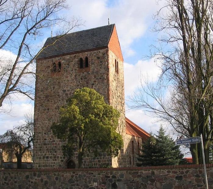
Photo: Lienhard Schulz, CC BY 2.5.
Village church Selchow is situated 1 km northeast of Keidel-Ranch Ponyhof Behrenbruch.
Berlin ExpoCenter Airport
Event venue

Photo: MB-one, CC BY-SA 4.0.
The Berlin ExpoCenter Airport is a multi-purpose exhibition centre on the perimeter of Berlin Brandenburg Airport. The ExpoCenter is built to host aviation-related fairs, like the ILA Berlin Air Show. Berlin ExpoCenter Airport is situated 1 km east of Keidel-Ranch Ponyhof Behrenbruch.
Places in the Area
Nearby places include Selchow and Waßmannsdorf.
Selchow
Village

Photo: Wikimedia, CC BY-SA 2.0.
The small village of Selchow is one of the six districts of the municipality of Schönefeld in the district of Dahme-Spreewald south of Berlin, Germany.
Waßmannsdorf
Village
Photo: Brücke-Osteuropa, CC0.
Waßmannsdorf is a village and a civil parish of the German town of Schönefeld, located in the district of Dahme-Spreewald in Brandenburg. As of 2007 its population was of around 1,000.
Klein Ziethen
Hamlet

Photo: Uckermaerker, CC BY-SA 4.0.
Klein Ziethen is a hamlet, which is situated 3 km north of Keidel-Ranch Ponyhof Behrenbruch.
Keidel-Ranch Ponyhof Behrenbruch
- Type: Equestrianism
- Categories: farm, recreation area, and sports location
- Location: Schönefeld, Dahme-Spreewald, Brandenburg, Germany, Central Europe, Europe
- View on OpenStreetMap
Latitude
52.35301° or 52° 21′ 11″ northLongitude
13.46188° or 13° 27′ 43″ eastOpen location code
9F4M9F36+6QOpenStreetMap ID
way 37012457OpenStreetMap feature
amenity=stablesOpenStreetMap feature
landuse=farmyardOpenStreetMap feature
leisure=horse_riding
This page is based on OpenStreetMap, Wikidata, and Wikimedia Commons.
We’d love your help improving our open data sources. Thank you for contributing.
Satellite Map
Discover Keidel-Ranch Ponyhof Behrenbruch from above in high-definition satellite imagery.
Notable Places Nearby
Highlights include Freiwillige Feuerwehr Selchow and Friedhof Selchow.
Nearby Places
Explore places such as T01 and Selchower See.
Brandenburg: Must-Visit Destinations
Delve into Potsdam, Cottbus, Frankfurt an der Oder, and Brandenburg an der Havel.
Curious Places to Discover
Uncover intriguing places from every corner of the globe.
About Mapcarta. Data © OpenStreetMap contributors and available under the Open Database License". Text is available under the CC BY-SA 4.0 license, except for photos, directions, and the map. Photo: Global Fish, CC BY-SA 4.0.