Kajtur ‘Poligon’
Kajtur ‘Poligon’ is a recreation area in Gmina Trzebiatów, Gryfice County, Zachodniopomorskie. Kajtur ‘Poligon’ is situated nearby to the hamlet Chełm Gryficki, as well as near the military installation Plac treningów ogniowych ‘Merida’.| Tap on a place to explore it |
Places of Interest Nearby
Highlights include St. Gertrude’s Chapel and Kaszana Tower in Trzebiatów.
St. Gertrude’s Chapel
Church

Photo: Kapitel, CC BY-SA 3.0 pl.
St. Gertrude’s Chapel is a church, which is situated 2 km southeast of Kajtur ‘Poligon’.
Kaszana Tower in Trzebiatów
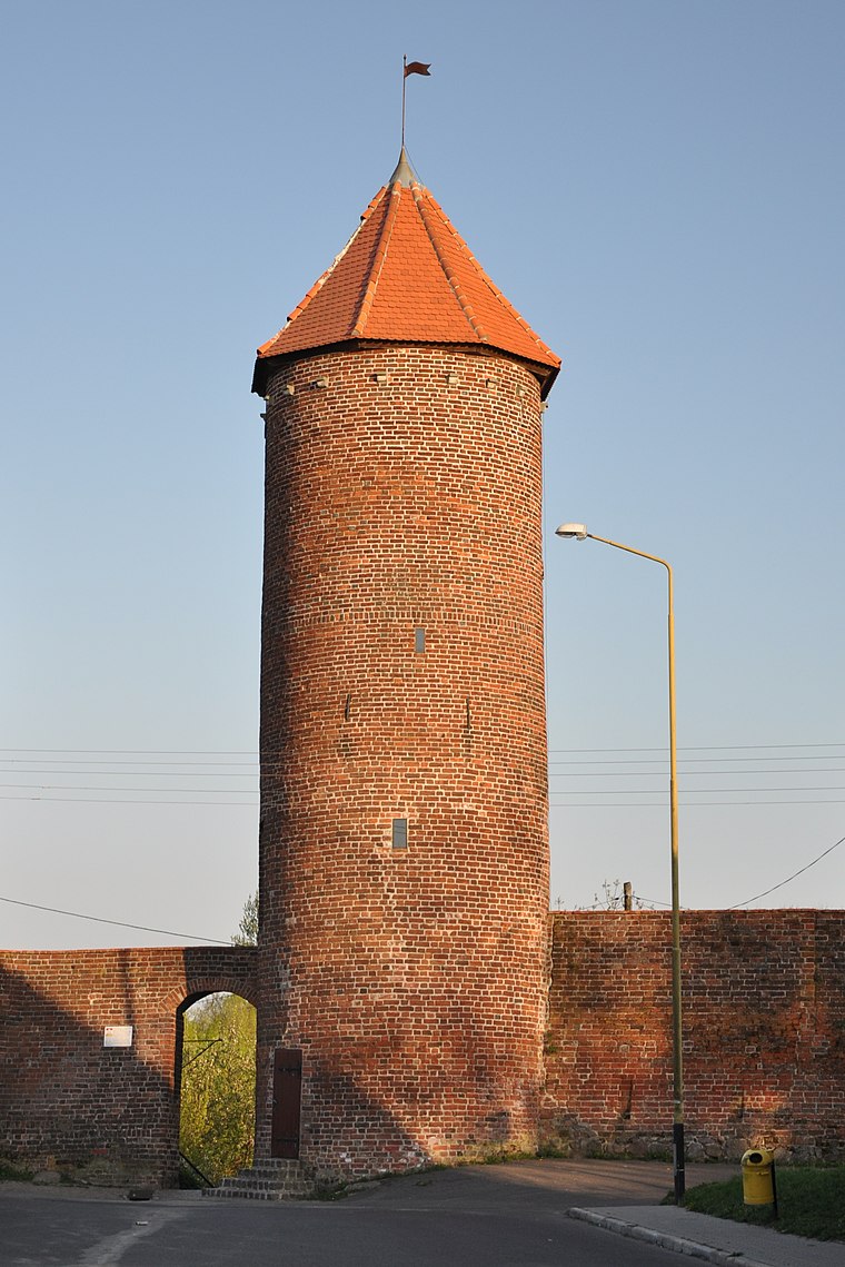
Photo: JDavid, CC BY-SA 4.0.
Kaszana Tower in Trzebiatów is situated 2 km east of Kajtur ‘Poligon’.
St. John Evangelical Church
Church

Photo: JDavid, CC BY-SA 3.0.
St. John Evangelical Church is situated 2 km east of Kajtur ‘Poligon’.
Places in the Area
Nearby places include Chełm Gryficki and Nowielice.
Chełm Gryficki
Hamlet
Chełm Gryficki is a village in the administrative district of Gmina Trzebiatów, within Gryfice County, West Pomeranian Voivodeship, in north-western Poland.
Nowielice
Village
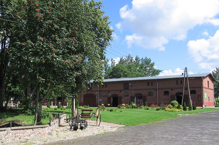
Photo: JDavid, Public domain.
Nowielice is a village in the administrative district of Gmina Trzebiatów, within Gryfice County, West Pomeranian Voivodeship, in north-western Poland.
Trzebiatów
Town

Photo: Wikimedia, CC BY-SA 3.0.
Trzebiatów is a town in the West Pomeranian Voivodeship, Poland, with 10,119 inhabitants. Trzebiatów is located on the Rega River in the north-western part of Poland, roughly 9 kilometers south of the Baltic coast.
Kajtur ‘Poligon’
- Type: Recreation area
- Categories: tourist attraction and tourism
- Location: Gmina Trzebiatów, Gryfice County, Zachodniopomorskie, Poland, Central Europe, Europe
- View on OpenStreetMap
Latitude
54.06734° or 54° 4′ 2″ northLongitude
15.23561° or 15° 14′ 8″ eastOpen location code
9F6Q368P+W6OpenStreetMap ID
way 373902156OpenStreetMap feature
landuse=recreation_ground
This page is based on OpenStreetMap, Wikidata, and Wikimedia Commons.
We’d love your help improving our open data sources. Thank you for contributing.
Satellite Map
Discover Kajtur ‘Poligon’ from above in high-definition satellite imagery.
Notable Places Nearby
Highlights include Plac treningów ogniowych ‘Merida’ and ruina przyczółku mostu.
Nearby Places
Explore places such as Kajtur Event and Chełm Gryficki.
Zachodniopomorskie: Must-Visit Destinations
Delve into Szczecin, Świnoujście, Koszalin, and Kołobrzeg.
Curious Recreation Areas to Discover
Uncover intriguing recreation areas from every corner of the globe.
About Mapcarta. Data © OpenStreetMap contributors and available under the Open Database License". Text is available under the CC BY-SA 4.0 license, except for photos, directions, and the map. Photo: Sicherlich, CC BY 3.0.