Webermörtel
Webermörtel is a farm in Pinggau, Hartberg-Fürstenfeld District, Styria. Webermörtel is situated nearby to the church Filialkirche Maria Hilf, Sparberegg, as well as near the ruins Kirchenruine hl. Nikolaus.| Tap on a place to explore it |
Places of Interest Nearby
Highlights include Schloss Bärnegg and Filialkirche Maria Hilf, Sparberegg.
Schloss Bärnegg
Castle

Photo: Ufoao, CC BY-SA 3.0 at.
Schloss Bärnegg is a castle, which is situated 1 km north of Webermörtel.
Filialkirche Maria Hilf, Sparberegg
Church
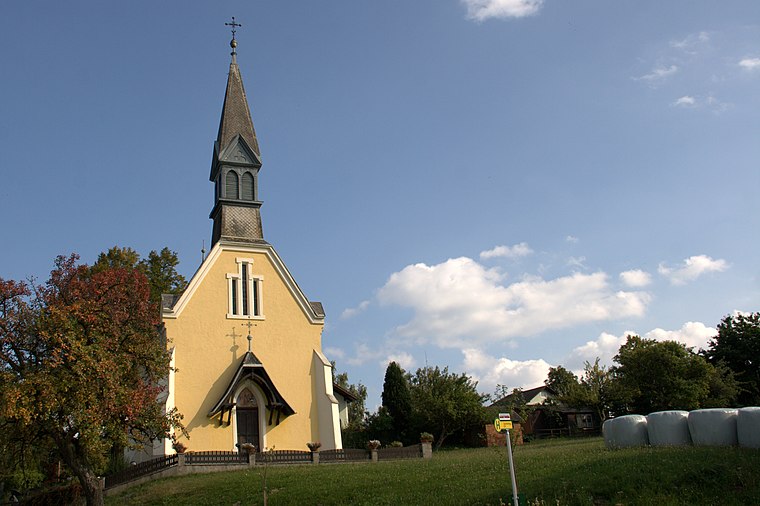
Photo: Wolf32at, CC BY-SA 3.0 at.
Filialkirche Maria Hilf, Sparberegg is a church, which is situated 1 km southeast of Webermörtel.
Filialkirche Hochart
Church

Photo: Ueb-at, CC BY-SA 3.0.
Filialkirche Hochart is a church, which is situated 3 km south of Webermörtel.
Places in the Area
Nearby places include Hochart and Friedberg.
Hochart
Village
Photo: Ueb-at, CC BY-SA 3.0.
Hochart is a village, which is situated 3 km south of Webermörtel.
Friedberg
Village

Photo: Wolf32at, CC BY-SA 3.0 at.
Friedberg is a town in the district of Hartberg-Fürstenfeld located in Styria, Austria with 2,562 inhabitants. Friedberg is situated 4 km west of Webermörtel.
Schreibersdorf
Village

Photo: Ueb-at, CC BY-SA 3.0.
Schreibersdorf is a village, which is situated 5 km southeast of Webermörtel.
Webermörtel
- Type: Farm
- Category: agriculture
- Location: Pinggau, Hartberg-Fürstenfeld District, Styria, Austria, Central Europe, Europe
- View on OpenStreetMap
Latitude
47.43025° or 47° 25′ 49″ northLongitude
16.11137° or 16° 6′ 41″ eastOpen location code
8FVRC4J6+4GOpenStreetMap ID
way 375254533OpenStreetMap feature
landuse=farmyard
This page is based on OpenStreetMap, Wikidata, and Wikimedia Commons.
We’d love your help improving our open data sources. Thank you for contributing.
Satellite Map
Discover Webermörtel from above in high-definition satellite imagery.
Notable Places Nearby
Highlights include Kirchenruine hl. Nikolaus and Kapelle.
Nearby Places
Explore places such as Abzweigung Eder and Abzweigung Eder.
Styria: Must-Visit Destinations
Delve into Graz, Leoben, Bruck an der Mur, and Kapfenberg.
Curious Farms to Discover
Uncover intriguing farms from every corner of the globe.
About Mapcarta. Data © OpenStreetMap contributors and available under the Open Database License". Text is available under the CC BY-SA 4.0 license, except for photos, directions, and the map. Photo: Kmarka, CC BY-SA 3.0.