Minigolfplatz Monrepos
Minigolfplatz Monrepos is a parking area in Ludwigsburg, Stuttgart, Baden-Württemberg. Minigolfplatz Monrepos is situated nearby to the miniature golf course Minigolfanlage Monrepos, as well as near Monrepos Palace.| Tap on a place to explore it |
- Type: Parking area
- Parking: surface
- Wheelchair access: limited
Places of Interest Nearby
Highlights include Monrepos Palace and St. Katharina.
Monrepos Palace

Photo: -donald-, CC BY-SA 3.0.
Monrepos is a lakeside schloss in Ludwigsburg, Germany. Although quite far and almost separate from Favorite Palace and Ludwigsburg Palace, it is connected to the rest of the grounds by way of pedestrian paths. Monrepos Palace is situated 320 metres west of Minigolfplatz Monrepos.
St. Katharina
Church
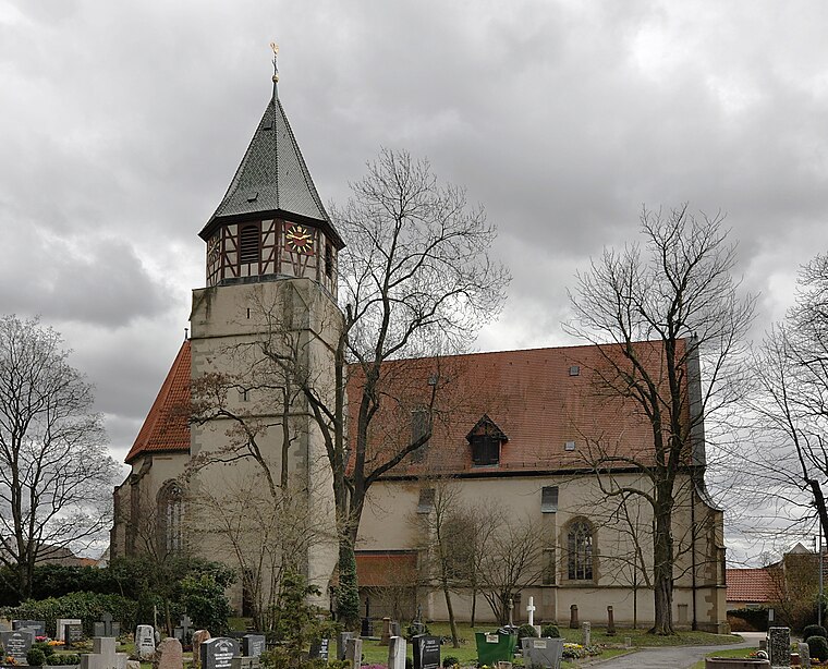
Photo: Wikimedia, CC BY-SA 3.0.
St. Katharina is a church, which is situated 1¼ km south of Minigolfplatz Monrepos.
Schloss Heutingsheim
Castle

Photo: Mussklprozz, CC BY-SA 4.0.
Schloss Heutingsheim is a castle, which is situated 1½ km northeast of Minigolfplatz Monrepos.
Places in the Area
Nearby places include Eglosheim and Freiberg am Neckar.

Freiberg am Neckar
Town

Photo: Mussklprozz, CC BY-SA 3.0.
Freiberg am Neckar is a town in the district of Ludwigsburg, Baden-Württemberg, Germany. It is situated on the left bank of the Neckar, 18 km north of Stuttgart, and 4 km north of Ludwigsburg.
Hoheneck
Suburb

Photo: Mussklprozz, CC BY-SA 3.0.
Hoheneck is a suburb, which is situated 2½ km east of Minigolfplatz Monrepos.
Minigolfplatz Monrepos
- Category: transportation
- Location: Ludwigsburg, Ludwigsburg, Stuttgart, Stuttgart Region, Baden-Württemberg, Germany, Central Europe, Europe
- View on OpenStreetMap
Latitude
48.91877° or 48° 55′ 8″ northLongitude
9.1737° or 9° 10′ 25″ eastOpen location code
8FWFW59F+GFOpenStreetMap ID
way 375527942OpenStreetMap feature
amenity=parkingOpenStreetMap attribute
parking=surfaceOpenStreetMap attribute
wheelchair=limited
This page is based on OpenStreetMap, Wikidata, and Wikimedia Commons.
We’d love your help improving our open data sources. Thank you for contributing.
Satellite Map
Discover Minigolfplatz Monrepos from above in high-definition satellite imagery.
Notable Places Nearby
Highlights include Minigolfanlage Monrepos and Kapelle (Ruine).
Nearby Places
Explore places such as L1138 and Monrepos (LB-Eglosheim).
Stuttgart Region: Must-Visit Destinations
Delve into Stuttgart, Esslingen, Sindelfingen, and Waiblingen.
Curious Parking Areas to Discover
Uncover intriguing parking areas from every corner of the globe.
About Mapcarta. Data © OpenStreetMap contributors and available under the Open Database License". Text is available under the CC BY-SA 4.0 license, except for photos, directions, and the map. Photo: Traveler100, CC BY-SA 3.0.