Bergsonhalle
Bergsonhalle is a sports venue in Munich, Upper Bavaria, Bavaria. Bergsonhalle is situated nearby to the railway station Munich-Langwied station, as well as near the school Staatliche Fachoberschule München-West.| Tap on a place to explore it |
Places of Interest Nearby
Highlights include Munich-Langwied station and Aubinger Heizkraftwerk.
Munich-Langwied station
Railway station

Photo: Flummi-2011, CC BY-SA 3.0.
Munich-Langwied station is a railway station in the Aubing-Lochhausen-Langwied borough of Munich, Germany. Munich-Langwied station is situated 120 metres west of Bergsonhalle.
Aubinger Heizkraftwerk
Arts center

Photo: Dietzel65, CC BY-SA 3.0 de.
Aubinger Heizkraftwerk is an arts center, which is situated 670 metres west of Bergsonhalle.
Blutenburg Castle
Castle

Photo: Carsten Steger, CC BY-SA 4.0.
Blutenburg Castle is an old ducal country seat in the west of Munich, Germany, on the banks of river Würm. Blutenburg Castle is situated 1½ km east of Bergsonhalle.
Places in the Area
Nearby places include Villenkolonie Pasing II and Villenkolonie Pasing I.
Villenkolonie Pasing II
Neighborhood
The Villenkolonie Pasing II is a single-family home colony in Munich-Pasing. It was built according to the model of a garden town.
Villenkolonie Pasing I
Neighborhood
The Villenkolonie Pasing I is a single-family house colony in Munich-Pasing. Villenkolonie Pasing I is situated 2½ km southeast of Bergsonhalle.
Pasing
Suburb
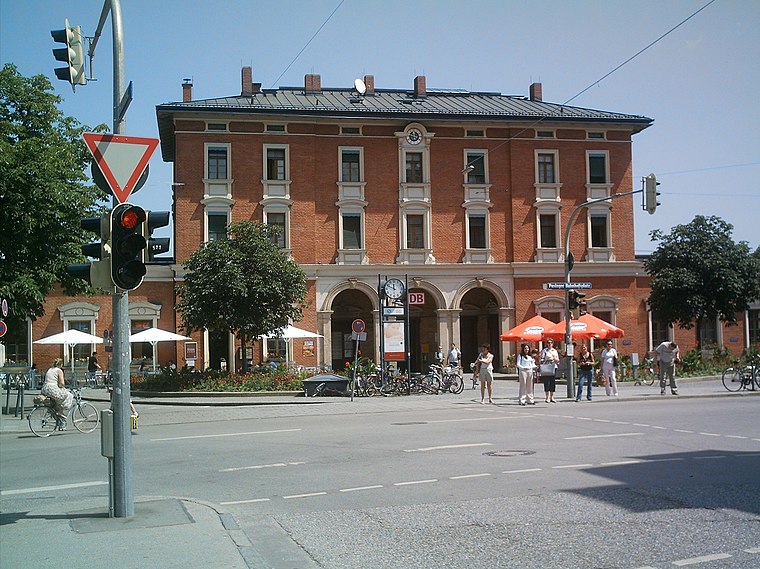
Photo: Rdb, CC BY-SA 3.0.
Pasing is a district in the city of Munich, Germany, and part of the borough Pasing-Obermenzing. Pasing is situated 2½ km southeast of Bergsonhalle.
Bergsonhalle
- Type: Sports venue
- Roof shape: flat
- Categories: building, recreation area, and sports location
- Location: Munich, Upper Bavaria, Bavaria, Germany, Central Europe, Europe
- View on OpenStreetMap
Latitude
48.16304° or 48° 9′ 47″ northLongitude
11.43403° or 11° 26′ 3″ eastOpen location code
8FWH5C7M+6JOpenStreetMap ID
way 37608006OpenStreetMap feature
building=sports_hallOpenStreetMap feature
leisure=sports_hallOpenStreetMap feature
sport=multiOpenStreetMap attribute
roof-shape=flat
This page is based on OpenStreetMap, Wikidata, and Wikimedia Commons.
We’d love your help improving our open data sources. Thank you for contributing.
Satellite Map
Discover Bergsonhalle from above in high-definition satellite imagery.
Notable Places Nearby
Highlights include Staatliche Fachoberschule München-West and ESV München West Tennis.
Nearby Places
Explore places such as Cafeteria and Städtische Berufsschule für Industrieelektronik.
Munich: Must-Visit Destinations
Delve into North Munich, Altstadt, Haidhausen, and Ludwigsvorstadt-Isarvorstadt.
Curious Sports Venues to Discover
Uncover intriguing sports venues from every corner of the globe.
About Mapcarta. Data © OpenStreetMap contributors and available under the Open Database License". Text is available under the CC BY-SA 4.0 license, except for photos, directions, and the map. Photo: Heav84, CC BY-SA 3.0.