Spielplatz Deutsche Scholle
Spielplatz Deutsche Scholle is a playground in Osnabrück, Western Plains, Lower Saxony. Spielplatz Deutsche Scholle is situated nearby to the community center KGV Deutsche Scholle - Vereinshaus, as well as near the church Adventgemeinde.| Tap on a place to explore it |
Places of Interest Nearby
Highlights include Moskaubad and OsnabrückHalle.
Moskaubad
Water park
The Moskaubad is a public swimming pool in the Wüste district of Osnabrück, Germany. It was first opened in 1926 as an outdoor swimming pool under the name of “Moskau”. Moskaubad is situated 350 metres east of Spielplatz Deutsche Scholle.
OsnabrückHalle
Community center
The OsnabrückHalle is a prominent events building in the city of Osnabrück, Lower Saxony, Germany. OsnabrückHalle is situated 1¼ km northeast of Spielplatz Deutsche Scholle.
Osnabrück Town Hall
Town hall
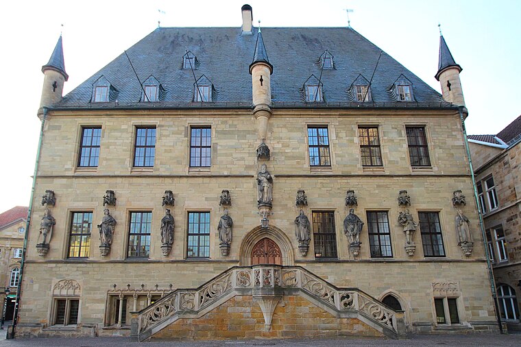
Photo: LigaDue, CC BY-SA 4.0.
The Town Hall of Osnabrück, Germany, was built in the late Gothic style from 1487 to 1512. It is one of Osnabrück's most important buildings and emblems and continues to be used as the city's town hall today. Osnabrück Town Hall is situated 2 km north of Spielplatz Deutsche Scholle.
Places in the Area
Nearby places include Kalkhügel and Innenstadt.
Kalkhügel
Suburb
Kalkhügel is a district of Osnabrück, Germany with a population of roughly 5,900 residents. It is home to both a Protestant and a Catholic church. There is also a school centre located in the district.
Innenstadt
Suburb
The Innenstadt is the central district of the city of Osnabrück in Lower Saxony, Germany; its population is roughly 8,300. The Innenstadt comprises the medieval Altstadt and Neustadt, which were united in 1306.
Heger-Tor-Viertel
Neighborhood

Photo: Timformatiker, CC BY-SA 4.0.
Heger-Tor-Viertel is a neighborhood.
Spielplatz Deutsche Scholle
- Type: Playground
- Wheelchair access: yes
- Category: recreation area
- Location: Osnabrück, Western Plains, Lower Saxony, Germany, Central Europe, Europe
- View on OpenStreetMap
Latitude
52.26263° or 52° 15′ 46″ northLongitude
8.03202° or 8° 1′ 55″ eastOperator
KGV Deutsche ScholleOpen location code
9F4C727J+3ROpenStreetMap ID
way 384990541OpenStreetMap feature
leisure=playgroundOpenStreetMap attribute
wheelchair=yes
This page is based on OpenStreetMap, Wikidata, and Wikimedia Commons.
We’d love your help improving our open data sources. Thank you for contributing.
Satellite Map
Discover Spielplatz Deutsche Scholle from above in high-definition satellite imagery.
Notable Places Nearby
Highlights include KGV Deutsche Scholle - Vereinshaus and Adventgemeinde.
Nearby Places
Explore places such as Die Scholle and KGV Deutsche Scholle.
Western Plains: Must-Visit Destinations
Delve into Oldenburg, Delmenhorst, Nordhorn, and Lingen.
Curious Playgrounds to Discover
Uncover intriguing playgrounds from every corner of the globe.
About Mapcarta. Data © OpenStreetMap contributors and available under the Open Database License". Text is available under the CC BY-SA 4.0 license, except for photos, directions, and the map. Photo: MrsMyer, CC BY-SA 3.0.