Saule Baumschulen
Saule Baumschulen is a plant nursery in Augsburg, Bavarian Swabia, Bavaria which is located on Mühlhauser Straße. Saule Baumschulen is situated nearby to the recreation area Lauterbacher am See, as well as near Kaisersee.| Tap on a place to explore it |
Places of Interest Nearby
Highlights include Augsburg Airport and Kaisersee.
Augsburg Airport
Aerodrome

Photo: Carsten Steger, CC BY-SA 4.0.
Augsburg Airport is a regional airport in Affing, 7 km northeast of the city of Augsburg, the third largest city in the German state of Bavaria. It is used for business and general aviation with very little passenger airline traffic.
Kaisersee

Photo: Mailtosap, CC BY-SA 3.0.
Kaisersee is a lake in Augsburg, Schwaben, Bavaria, Germany. Its surface area is 4 ha. Kaisersee is situated 740 metres north of Saule Baumschulen.
Abfallverwertungsanlage Augsburg
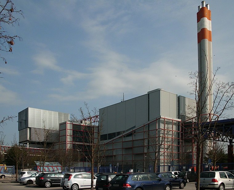
Photo: Mailtosap, CC BY-SA 3.0.
Abfallverwertungsanlage Augsburg is situated 1½ km southeast of Saule Baumschulen.
Places in the Area
Nearby places include Augsburg-Hammerschmiede and Augsburg-Firnhaberau.
Augsburg-Hammerschmiede
Suburb
Hammerschmiede is one of the seventeen highest-level civic divisions, or planning districts, of Augsburg, Bavaria, Germany. As of January 1, 2006, it is estimated to have a population of 6,574.
Augsburg-Firnhaberau
Suburb

Photo: Mailtosap, CC BY-SA 3.0.
Firnhaberau is the 28th Stadtbezirk, or city district, of Augsburg, Bavaria, Germany. It currently makes up the entire 4th Planungsraum, or planning district, of Augsburg. The district has a population of approximately 5,500 and an area of 7.42 km2.
Gersthofen
Town

Photo: Flodur63, CC BY-SA 4.0.
Gersthofen is a town in the district of Augsburg, in Bavaria, Germany. It is situated on the west bank of the river Lech, approx. 7 km north of Augsburg. Gersthofen is situated 3½ km northwest of Saule Baumschulen.
Saule Baumschulen
- Type: Plant nursery
- Address: Mühlhauser Straße 55, Hammerschmiede, Augsburg, 86169
- Category: agriculture
- Location: Augsburg, Bavarian Swabia, Bavaria, Germany, Central Europe, Europe
- View on OpenStreetMap
Latitude
48.41272° or 48° 24′ 46″ northLongitude
10.9188° or 10° 55′ 8″ eastOpen location code
8FWGCW79+3GOpenStreetMap ID
way 388891162OpenStreetMap feature
landuse=plant_nursery
This page is based on OpenStreetMap, Wikidata, and Wikimedia Commons.
We’d love your help improving our open data sources. Thank you for contributing.
Satellite Map
Discover Saule Baumschulen from above in high-definition satellite imagery.
Notable Places Nearby
Highlights include Lauterbacher am See and Traningsgelände der SV Hammerschmiede.
Nearby Places
Explore places such as Campingplatz Bella Augusta and TotalEnergies.
Bavarian Swabia: Must-Visit Destinations
Delve into Memmingen, Kempten, Füssen, and Lindau.
Curious Plant Nurseries to Discover
Uncover intriguing plant nurseries from every corner of the globe.
About Mapcarta. Data © OpenStreetMap contributors and available under the Open Database License". Text is available under the CC BY-SA 4.0 license, except for photos, directions, and the map. Photo: Tilman2007, CC BY-SA 3.0.