Gobierno Autonomo Descentralizado de Pimampiro
Gobierno Autonomo Descentralizado de Pimampiro is a town hall in Pimampiro, Imbabura which is located on Flores e Imbabura. Gobierno Autonomo Descentralizado de Pimampiro is situated nearby to the park Parque 24 de mayo, as well as near the government office Registro Civil.| Tap on a place to explore it |
Places of Interest Nearby
Highlights include Pimampiro.
Pimampiro
Residential area
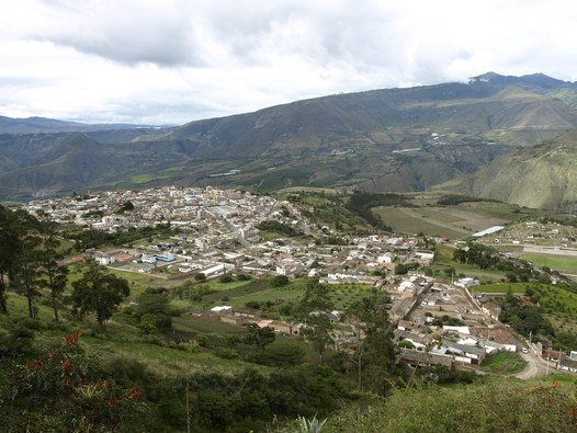
Photo: Estrada Pablo, CC BY-SA 4.0.
Pimampiro, also Pimampiru, is the seat of Pimampiro Canton, Imbabura Province, Ecuador. The town is located at an elevation of 2,163 metres. It had a population of 4,654 in the 2001 census and 5,138 in 2010.
Places in the Area
Nearby places include Ambuquí.
Ambuquí
Village
Ambuquí is a rural parish in northern Ecuador in the Imbabura Province. It is located in the Chota Valley 29 km away from Ibarra. The parish is also considered one of the major producers of the reddish yellow variety of the Spondias purpurea in the country. Ambuquí is situated 9 km northwest of Gobierno Autonomo Descentralizado de Pimampiro.
Gobierno Autonomo Descentralizado de Pimampiro
- Type: Town hall
- Address: Flores e Imbabura, Pimampro, 100117
- Categories: building and government building
- Location: Pimampiro, Pimampiro Canton, Imbabura, Ecuador, South America
- View on OpenStreetMap
Latitude
0.39032° or 0° 23′ 25″ northLongitude
-77.93935° or 77° 56′ 22″ westOperator
GAD PimampiroOpen location code
67G493R6+47OpenStreetMap ID
way 395651282OpenStreetMap feature
amenity=townhallOpenStreetMap feature
building=yes
This page is based on OpenStreetMap, Wikidata, and Wikimedia Commons.
We’d love your help improving our open data sources. Thank you for contributing.
Satellite Map
Discover Gobierno Autonomo Descentralizado de Pimampiro from above in high-definition satellite imagery.
Notable Places Nearby
Highlights include Parque 24 de mayo and Registro Civil.
Nearby Places
Explore places such as Peluqueria Ximena and Coop. de Ahorro y Crédito ‘San Gabriel’ Ltda..
Ecuador: Must-Visit Destinations
Delve into Quito, Guayaquil, Chimborazo, and Cuenca.
Curious Town Halls to Discover
Uncover intriguing town halls from every corner of the globe.
About Mapcarta. Data © OpenStreetMap contributors and available under the Open Database License". Text is available under the CC BY-SA 4.0 license, except for photos, directions, and the map. Photo: Wikimedia, CC0.