Subestação de Mosteiró
Subestação de Mosteiró is an electrical substation in Vilar e Mosteiró, Vila do Conde, Porto District. Subestação de Mosteiró is situated nearby to the sports venue Parque Desportivo de Arões, as well as near the village Gião.| Tap on a place to explore it |
Places of Interest Nearby
Highlights include Vilar do Pinheiro metro station and Castro de Alvarelhos.
Vilar do Pinheiro metro station
Railway station

Photo: Ernstkers, CC BY-SA 4.0.
Vilar do Pinheiro metro station is a railway station, which is situated 3 km southwest of Subestação de Mosteiró.
Castro de Alvarelhos
Archaeological site

Photo: Henrique Matos, CC BY 2.5.
Castro de Alvarelhos is an archaeological site, which is situated 3½ km northeast of Subestação de Mosteiró.
Modivas Sul metro station
Railway station
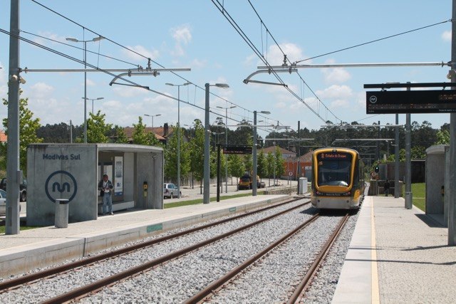
Photo: Ernstkers, CC BY-SA 4.0.
Modivas Sul metro station is a railway station, which is situated 3½ km west of Subestação de Mosteiró.
Places in the Area
Nearby places include Gião and Modivas.
Gião
Village
Gião is a civil parish in the municipality of Vila do Conde, Portugal. The population in 2011 was 1,756, in an area of 5.66 km². Gião is situated 3½ km northwest of Subestação de Mosteiró.
Modivas
Village

Photo: Ernstkers, CC BY-SA 4.0.
Modivas is a civil parish in the municipality of Vila do Conde, Portugal. The population in 2011 was 1,806, in an area of 4.10 km². Modivas is situated 3½ km west of Subestação de Mosteiró.
Castêlo da Maia
Town

Photo: Hipersyl, Public domain.
Castêlo da Maia is a town and parish in Maia Municipality, Grande Porto, Portugal. As of the 2021 Census, it has 18,587 inhabitants. Castêlo da Maia is situated 4 km southeast of Subestação de Mosteiró.
Subestação de Mosteiró
- Type: Electrical substation
- Category: industry
- Location: Vilar e Mosteiró, Vila do Conde, Porto District, Portugal, Iberia, Europe
- View on OpenStreetMap
Latitude
41.28516° or 41° 17′ 7″ northLongitude
-8.6518° or 8° 39′ 7″ westOperator
E-REDESOpen location code
8CHH78PX+37OpenStreetMap ID
way 397546811OpenStreetMap feature
landuse=industrial
This page is based on OpenStreetMap, Wikidata, and Wikimedia Commons.
We’d love your help improving our open data sources. Thank you for contributing.
Satellite Map
Discover Subestação de Mosteiró from above in high-definition satellite imagery.
Notable Places Nearby
Highlights include Parque Desportivo de Arões and Capela de Santo António.
Nearby Places
Explore places such as Cruzeiro de Arões and Arões.
Portugal: Must-Visit Destinations
Delve into Lisbon, Caldas da Rainha, Porto, and Coimbra.
Curious Electrical Substations to Discover
Uncover intriguing electrical substations from every corner of the globe.
About Mapcarta. Data © OpenStreetMap contributors and available under the Open Database License". Text is available under the CC BY-SA 4.0 license, except for photos, directions, and the map. Photo: Jcchemical, CC BY-SA 3.0.