Ungdomskirken Aarhus
Ungdomskirken Aarhus is a church in Aarhus Municipality, Central Jutland. Ungdomskirken Aarhus is situated nearby to the community center Lilleby, as well as near the building Elvirasminde.| Tap on a place to explore it |
- Type: Church
- Denomination: Lutheran
- Wheelchair access: yes
Places of Interest Nearby
Highlights include Øst for Paradis and Church of Our Lady.
Øst for Paradis
Movie theater
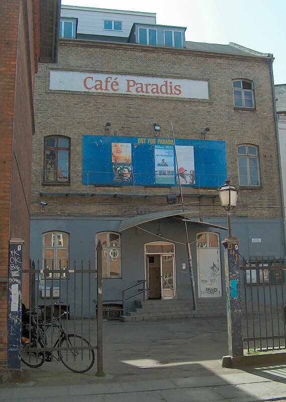
Photo: Villy Fink Isaksen, Public domain.
Øst for Paradis is an art cinema in Aarhus, Denmark founded in 1978. Øst for Paradis is situated 160 metres east of Ungdomskirken Aarhus.
Church of Our Lady
Church

Photo: Nico-dk, CC BY-SA 3.0.
The Church of Our Lady is one of the larger church structures of Århus, Denmark. It is situated in the centre of the city not far from Aarhus Cathedral. Church of Our Lady is situated 240 metres southwest of Ungdomskirken Aarhus.
Cathedral
Church

Photo: Villy Fink Isaksen, Public domain.
Aarhus Cathedral is a cathedral in Aarhus, Denmark. It is the longest and tallest church in the country, at 93 m in length and 96 m in height. The construction of Aarhus Cathedral began in the 12th century and it is the main edifice of the diocese of Aarhus for the Church of Denmark, dedicated to the patron saint of sailors, St Clemens. Cathedral is situated 420 metres southeast of Ungdomskirken Aarhus.
Places in the Area
Nearby places include Latin Quarter and Nørre Stenbro.
Latin Quarter
Neighborhood

Photo: RhinoMind, CC BY-SA 3.0.
The Latin Quarter in Aarhus is the oldest part of the city and is itself part of the inner city. The quarter comprise the streets of Badstuegade, Klostergade, Volden, Studsgade, Borggade, Rosensgade, Mejlgade and Graven, with Pustervig Torv as the main square.
Nørre Stenbro
Neighborhood

Photo: Nico-dk, CC BY-SA 3.0.
Nørre Stenbro is a small neighborhood in the city of Aarhus, Denmark home to some 3,000 residents. The neighborhood is part of the Aarhus C district and borders the neighborhoods of Indre By south and west, Aarhus Docklands in the east and Trøjborg north.
Midtbyen
Neighborhood

Photo: Wikimedia, CC BY-SA 4.0.
Midtbyen, also known as Aarhus Center or City, is the inner part of Aarhus. Midtbyen is part of district Aarhus C, mainly with postal code 8000, together with Vesterbro, Nørre Stenbro Trøjborg and Frederiksbjerg and has a population of around 90000.
Ungdomskirken Aarhus
- Categories: building, place of worship, and religion
- Location: Aarhus Municipality, Central Jutland, Denmark, Nordic countries, Europe
- View on OpenStreetMap
Latitude
56.15998° or 56° 9′ 36″ northLongitude
10.20676° or 10° 12′ 24″ eastNamed after
AarhusOpen location code
9F8G5654+XPOpenStreetMap ID
way 399077476OpenStreetMap feature
amenity=place_of_worshipOpenStreetMap feature
building=churchOpenStreetMap attribute
denomination=lutheranOpenStreetMap attribute
wheelchair=yes
This page is based on OpenStreetMap, Wikidata, and Wikimedia Commons.
We’d love your help improving our open data sources. Thank you for contributing.
Satellite Map
Discover Ungdomskirken Aarhus from above in high-definition satellite imagery.
Notable Places Nearby
Highlights include Lilleby and Elvirasminde.
Nearby Places
Explore places such as Cut and style and BATOs Pizza & Grill Århus.
Denmark: Must-Visit Destinations
Delve into Copenhagen, Aarhus, Odense, and Aalborg.
Curious Churches to Discover
Uncover intriguing churches from every corner of the globe.
About Mapcarta. Data © OpenStreetMap contributors and available under the Open Database License". Text is available under the CC BY-SA 4.0 license, except for photos, directions, and the map. Photo: Wikimedia, CC BY-SA 3.0.