Anton-Österreicher-Platz
Anton-Österreicher-Platz is a parking area in Wiesbaden, South Hesse, Hesse. Anton-Österreicher-Platz is situated nearby to the fire station Freiwillige Feuerwehr Medenbach, as well as near the public building Bürgerhaus.| Tap on a place to explore it |
Places of Interest Nearby
Highlights include Wickerbachtal bei Kloppenheim and Evangelische Kirche Wildsachsen.
Wickerbachtal bei Kloppenheim
Nature reserve

Photo: Shumwai, CC BY-SA 4.0.
Wickerbachtal bei Kloppenheim is a nature reserve.
Evangelische Kirche Wildsachsen
Church

Photo: Karsten11, Public domain.
Evangelische Kirche Wildsachsen is a church, which is situated 1½ km northeast of Anton-Österreicher-Platz.
Autobahnkirche Medenbach
Church
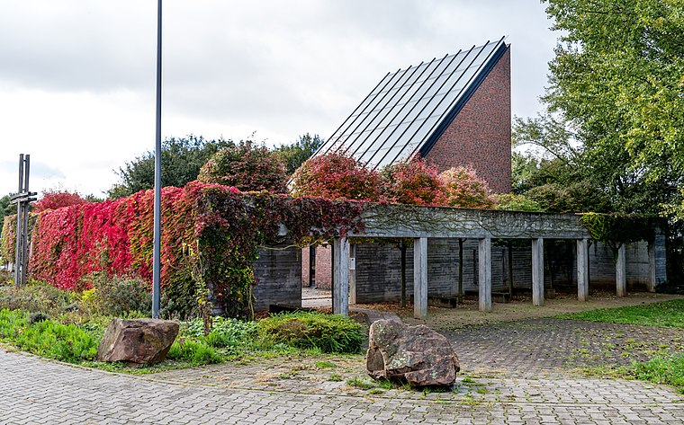
Photo: Joergens.mi, CC BY-SA 3.0.
Autobahnkirche Medenbach is a church, which is situated 2 km southeast of Anton-Österreicher-Platz.
Places in the Area
Nearby places include Kloppenheim and Wiesbaden-Heßloch.
Kloppenheim
Village

Photo: Brühl, Public domain.
Kloppenheim is a borough of Wiesbaden, capital of the federal state of Hesse, Germany. Kloppenheim was incorporated into Wiesbaden in 1928. The adjacent boroughs are Naurod, Auringen, Medenbach, Igstadt, Bierstadt, and Heßloch. Kloppenheim is situated 3 km southwest of Anton-Österreicher-Platz.
Wiesbaden-Heßloch
Village

Photo: Brühl, Public domain.
Hessloch is a borough of Wiesbaden, the capital of the state of Hessen, Germany. It is the smallest and least-populated of Wiesbaden's boroughs with 663 residents. Wiesbaden-Heßloch is situated 3 km west of Anton-Österreicher-Platz.
Igstadt
Village

Photo: Brühl, Public domain.
Igstadt is an eastern borough of Wiesbaden, capital of the state of Hesse, Germany. It was incorporated into Wiesbaden on April 1, 1928 and currently has about 2,200 residents. Igstadt is situated 3½ km south of Anton-Österreicher-Platz.
Anton-Österreicher-Platz
- Type: Parking area
- Parking: surface
- Category: transportation
- Location: Wiesbaden, South Hesse, Hesse, Germany, Central Europe, Europe
- View on OpenStreetMap
Latitude
50.11044° or 50° 6′ 38″ northLongitude
8.34018° or 8° 20′ 25″ eastOpen location code
9F2C486R+53OpenStreetMap ID
way 400286862OpenStreetMap feature
amenity=parkingOpenStreetMap attribute
parking=surface
This page is based on OpenStreetMap, Wikidata, and Wikimedia Commons.
We’d love your help improving our open data sources. Thank you for contributing.
Satellite Map
Discover Anton-Österreicher-Platz from above in high-definition satellite imagery.
Notable Places Nearby
Highlights include Freiwillige Feuerwehr Medenbach and Bürgerhaus.
Nearby Places
Explore places such as Am Sportfeld and Am Sportfeld.
South Hesse: Must-Visit Destinations
Delve into Darmstadt, Bensheim, Lorsch, and Heppenheim.
Curious Parking Areas to Discover
Uncover intriguing parking areas from every corner of the globe.
About Mapcarta. Data © OpenStreetMap contributors and available under the Open Database License". Text is available under the CC BY-SA 4.0 license, except for photos, directions, and the map. Photo: Pedelecs, CC BY-SA 3.0.