Communauté d’Agglomération Hérault-Méditerranée
Communauté d’Agglomération Hérault-Méditerranée is a public building in Saint-Thibéry, Arrondissement of Béziers, Occitanie. Communauté d’Agglomération Hérault-Méditerranée is situated nearby to the winery Cave Coopérative, as well as near the fire station Centre d’incendie et de secours de Saint-Thibéry.| Tap on a place to explore it |
Places of Interest Nearby
Highlights include Abbaye de Saint-Thibéry and Église Saint-Thibéry de Saint-Thibéry.
Abbaye de Saint-Thibéry
Monastery

Photo: Fagairolles 34, CC BY-SA 4.0.
Abbaye de Saint-Thibéry is a monastery, which is situated 610 metres north of Communauté d’Agglomération Hérault-Méditerranée.
Église Saint-Thibéry de Saint-Thibéry
Church
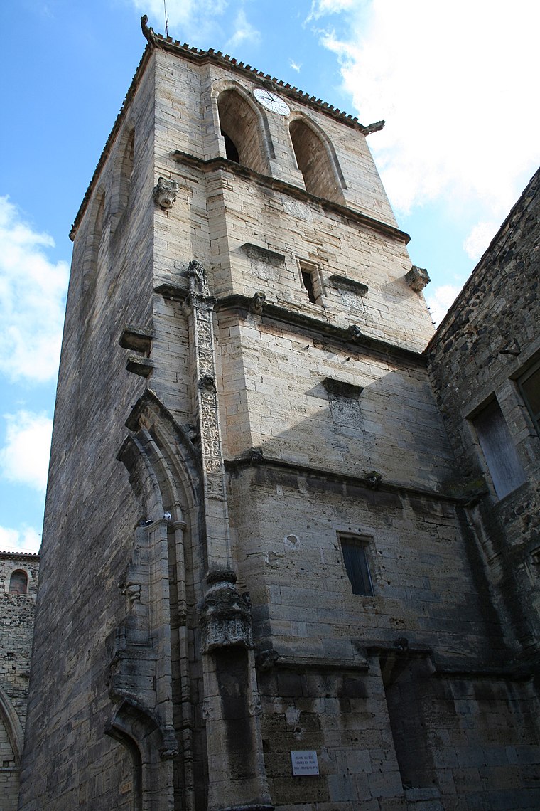
Photo: Fagairolles 34, CC BY-SA 4.0.
Église Saint-Thibéry de Saint-Thibéry is a church, which is situated 660 metres north of Communauté d’Agglomération Hérault-Méditerranée.
Roman Bridge
Ruins

Photo: Fagairolles 34, CC BY-SA 4.0.
The Roman Bridge at Saint-Thibéry was a Roman bridge on the Via Domitia in southern France. The partly surviving structure crossed the river Hérault in Saint-Thibéry, 17 km east of Béziers. Roman Bridge is situated 1¼ km east of Communauté d’Agglomération Hérault-Méditerranée.
Places in the Area
Nearby places include Pomerols and Pézenas.
Pomerols

Photo: Fagairolles 34, CC BY-SA 4.0.
Pomérols is a commune in the Hérault department in the Occitanie region in southern France.
Pézenas

Photo: Christian Ferrer, CC BY-SA 4.0.
Pézenas is a commune in the Hérault department in the Occitanie region in southern France.
Marseillan
Village

Photo: Marseillan34340, CC BY-SA 4.0.
Marseillan is a resort town and commune in the Hérault department in southern France. As of 2022, the population of Marseillan is 8,047. The port of Marseillan is a protected heritage site, and the altar and organ in the church are also listed. Marseillan is situated 10 km southeast of Communauté d’Agglomération Hérault-Méditerranée.
Communauté d’Agglomération Hérault-Méditerranée
- Type: Public building
- Categories: government office, building, office, and government building
- Location: Saint-Thibéry, Arrondissement of Béziers, Hérault, Occitanie, France, Europe
- View on OpenStreetMap
Latitude
43.39136° or 43° 23′ 29″ northLongitude
3.41893° or 3° 25′ 8″ eastOpen location code
8FM59CR9+GHOpenStreetMap ID
way 401672842OpenStreetMap feature
building=publicOpenStreetMap feature
office=government
This page is based on OpenStreetMap, Wikidata, and Wikimedia Commons.
We’d love your help improving our open data sources. Thank you for contributing.
Satellite Map
Discover Communauté d’Agglomération Hérault-Méditerranée from above in high-definition satellite imagery.
Notable Places Nearby
Highlights include Cave Coopérative and Centre d’incendie et de secours de Saint-Thibéry.
Nearby Places
Explore places such as Arcade and Le Causse.
Hérault: Must-Visit Destinations
Delve into Montpellier, Béziers, Sète, and Bouzigues.
Curious Public Buildings to Discover
Uncover intriguing public buildings from every corner of the globe.
About Mapcarta. Data © OpenStreetMap contributors and available under the Open Database License". Text is available under the CC BY-SA 4.0 license, except for photos, directions, and the map. Photo: Ondřej Žváček, CC BY 2.5.