Wildtierhotel Mohnblume
Wildtierhotel Mohnblume is a building in Bavaria, Germany. Wildtierhotel Mohnblume is situated nearby to the forest Erlau, as well as near the village Zeholfing.| Tap on a place to explore it |
Places of Interest Nearby
Highlights include Landau (Isar) and Kastenhof Landau - The museum für Stone Age and present.
Landau (Isar)
Railway station
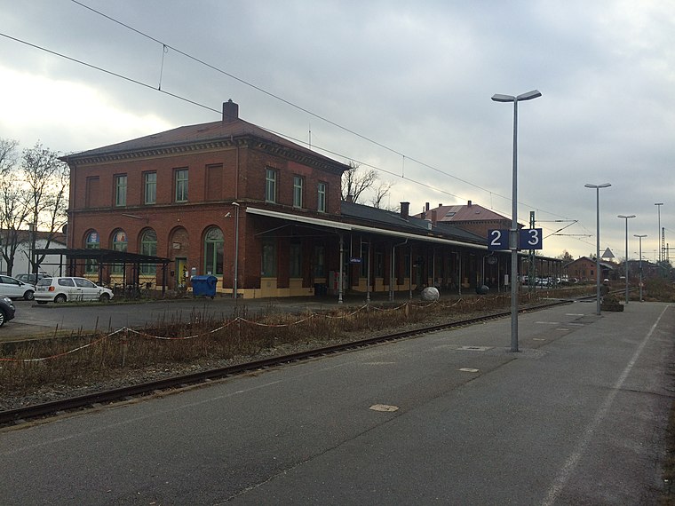
Photo: MaxEmanuel, CC BY-SA 4.0.
Landau (Isar) is a railway station, which is situated 2½ km southwest of Wildtierhotel Mohnblume.
Kastenhof Landau - The museum für Stone Age and present
Museum

Photo: Kastenhof Landau, CC BY-SA 4.0.
Kastenhof Landau - The museum für Stone Age and present is situated 3½ km southwest of Wildtierhotel Mohnblume.
Heilig Geist
Church

Photo: Gliwi, CC BY-SA 4.0.
Heilig Geist is a church, which is situated 3 km southwest of Wildtierhotel Mohnblume.
Places in the Area
Nearby places include Zeholfing and Landau an der Isar.
Zeholfing
Village

Photo: Konrad Lackerbeck, CC0.
Zeholfing is a village, which is situated 3 km east of Wildtierhotel Mohnblume.
Landau an der Isar
Town

Photo: Konrad Lackerbeck, CC BY 3.0.
Landau an der Isar is the second-largest town in the Lower Bavarian district, or Landkreis, of Dingolfing-Landau, in the state of Bavaria, Germany. It lies on the river Isar, 120 km downstream from Munich. In 2020, its population was around 14,000. Landau an der Isar is situated 3½ km southwest of Wildtierhotel Mohnblume.
Wallersdorf
Village

Photo: Donaulustig, Public domain.
Wallersdorf is a market town and municipality in the district of Dingolfing-Landau in Bavaria in Germany. Wallersdorf is situated 5 km northeast of Wildtierhotel Mohnblume.
Wildtierhotel Mohnblume
- Type: Building
- Roof shape: pyramidal
- Location: Bavaria, Germany, Central Europe, Europe
- View on OpenStreetMap
Latitude
48.69288° or 48° 41′ 34″ northLongitude
12.72398° or 12° 43′ 26″ eastInception
2011Operator
Bund Naturschutz OG Landau e.V.Open location code
8FWJMPVF+5HOpenStreetMap ID
way 404121019OpenStreetMap feature
building=transformer_towerOpenStreetMap feature
man_made=species_protection_towerOpenStreetMap attribute
roof-shape=pyramidal
This page is based on OpenStreetMap, Wikidata, and Wikimedia Commons.
We’d love your help improving our open data sources. Thank you for contributing.
Satellite Map
Discover Wildtierhotel Mohnblume from above in high-definition satellite imagery.
Notable Places Nearby
Highlights include Tannegg and Erlau.
Nearby Places
Explore places such as Frammeringermoos, Haidlfinger Straße and Zeilstadt.
Bavaria: Must-Visit Destinations
Delve into Munich, Nuremberg, Augsburg, and Erlangen.
Curious Buildings to Discover
Uncover intriguing buildings from every corner of the globe.
About Mapcarta. Data © OpenStreetMap contributors and available under the Open Database License". Text is available under the CC BY-SA 4.0 license, except for photos, directions, and the map. Photo: gravitat-OFF, CC BY 2.0.