Finca la Campana
Finca la Campana is a chalet in Álora, Valle del Guadalhorce, Andalusia. Finca la Campana is situated nearby to Horse Riding El Chorro, as well as near the peak Cerro de los Hornos.| Tap on a place to explore it |
Places of Interest Nearby
Highlights include El Chorro train station and Tajo de la Encantada hydro power plant.
El Chorro train station
Railway station

Photo: Kulmalukko, CC BY-SA 3.0.
El Chorro train station is a railway station, which is situated 1 km west of Finca la Campana.
Tajo de la Encantada hydro power plant
Power station
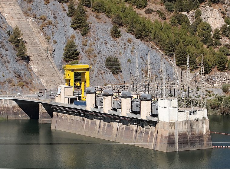
Photo: Kulmalukko, CC BY-SA 3.0.
Tajo de la Encantada hydro power plant is a power station, which is situated 1¼ km west of Finca la Campana.

Places in the Area
Nearby places include Valle de Abdalajís and Carratraca.
Valle de Abdalajís
Village

Photo: Phillip Capper, CC BY 2.0.
Valle de Abdalajís is a town and municipality in the province of Málaga, part of the autonomous community of Andalucía in southern Spain. It is located in the comarca of Antequera. Valle de Abdalajís is situated 7 km northeast of Finca la Campana.
Carratraca
Village
 Carratraca is a town and municipality in the province of Málaga, part of the autonomous community of Andalusia in southern Spain. The municipality is situated approximately 56 km from Ronda and from the provincial capital of Málaga. Carratraca is situated 9 km southwest of Finca la Campana.
Ardales
Village

Photo: José F. Martínez Rivero, CC BY-SA 3.0.
Ardales is a town and municipality in the Province of Málaga, part of the autonomous community of Andalusia in southern Spain. The municipality is approximately 62.5 kilometres from Málaga. Ardales is situated 9 km west of Finca la Campana.
Finca la Campana
- Type: Chalet
- Categories: building, tourism, and accommodation
- Location: Álora, Valle del Guadalhorce, Málaga, Andalusia, Spain, Iberia, Europe
- View on OpenStreetMap
Latitude
36.90508° or 36° 54′ 18″ northLongitude
-4.74838° or 4° 44′ 54″ westOpen location code
8C8QW742+2JOpenStreetMap ID
way 406574218OpenStreetMap feature
building=yesOpenStreetMap feature
tourism=chalet
This page is based on OpenStreetMap, Wikidata, and Wikimedia Commons.
We’d love your help improving our open data sources. Thank you for contributing.
Satellite Map
Discover Finca la Campana from above in high-definition satellite imagery.
Notable Places Nearby
Highlights include Horse Riding El Chorro and Cerro de los Hornos.
Nearby Places
Explore places such as Finca La Campana El Chorro and Olive Branch, El Chorro.
Málaga: Must-Visit Destinations
Delve into Málaga, Marbella, Ronda, and Antequera.
Curious Chalets to Discover
Uncover intriguing chalets from every corner of the globe.
About Mapcarta. Data © OpenStreetMap contributors and available under the Open Database License". Text is available under the CC BY-SA 4.0 license, except for photos, directions, and the map. Photo: Andrzej O, CC BY-SA 3.0.