Empare Dado
Empare Dado is a fast food restaurant in Santo Domingo De Guzmán (Zona Urbana), Santo Domingo, Nacional which is located on Avenida Gustavo Mejía Ricart. Empare Dado is situated nearby to the shopping center Plaza Cristal, as well as near Plaza Comercial I.| Tap on a place to explore it |
Places of Interest Nearby
Highlights include Embassy of France and Central Santo Domingo.
Embassy of France
Government office

Photo: I.Pjt, CC BY-SA 4.0.
Embassy of France is a government office, which is situated 300 metres west of Empare Dado.
Central Santo Domingo
Residential area
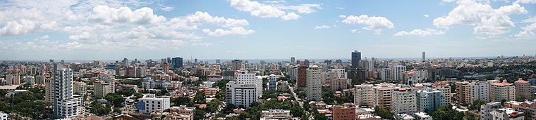
Photo: BigGabriel555, GFDL.
Central Santo Domingo or better known as Polígono Central is a term used to group several neighborhoods located in central Santo Domingo, Distrito Nacional, Dominican Republic defined as the area delineated by John F Kennedy Avenue on the north, on the west by Winston Churchill avenue, on the east by Maximo Gomez avenue, and on the south by 27 de Febrero avenue. Central Santo Domingo is situated 260 metres southwest of Empare Dado.
Félix Sánchez Olympic Stadium
Stadium

Photo: ThePapo309, CC BY-SA 4.0.
The Estadio Olímpico Félix Sánchez is an open-air multi-purpose stadium in Santo Domingo, Dominican Republic. Opened in 1974 for the XII Central American & Caribbean Games and renovated for the 2003 Pan American Games, it is the largest stadium in the Dominican Republic. Félix Sánchez Olympic Stadium is situated 1½ km east of Empare Dado.
Places in the Area
Nearby places include Puerto Isabela and Ciudad Colonial.
Puerto Isabela
Neighborhood
Puerto Isabela is a Sector in the city of Santo Domingo in the Distrito Nacional of the Dominican Republic. This neighborhood is populated in particular by individuals from the middle class. Puerto Isabela is situated 4 km north of Empare Dado.
Ciudad Colonial
Village

Photo: Mariordo, CC BY-SA 4.0.
Ciudad Colonial is the historic central neighborhood of the Dominican Republic's capital Santo Domingo. It is the oldest continuously inhabited European-established settlement in the Americas. Ciudad Colonial is situated 4½ km east of Empare Dado.
Altos de Arroyo Hondo
Neighborhood
Altos de Arroyo Hondo is a neighbourhood in the city of Santo Domingo in the Distrito Nacional of the Dominican Republic. This neighbourhood is populated in particular by individuals from the upper middle and upper classes. Altos de Arroyo Hondo is situated 5 km northwest of Empare Dado.
Empare Dado
- Type: Fast food restaurant
- Address: Avenida Gustavo Mejía Ricart, Santo Domingo, 10125
- Categories: building, food, and restaurant
- Location: Santo Domingo De Guzmán (Zona Urbana), Santo Domingo De Guzmán, Santo Domingo, Nacional, Greater Santo Domingo, Dominican Republic, Caribbean, North America
- View on OpenStreetMap
Latitude
18.47564° or 18° 28′ 32″ northLongitude
-69.93162° or 69° 55′ 54″ westOpen location code
77CGF3G9+79OpenStreetMap ID
way 410373880OpenStreetMap feature
amenity=fast_foodOpenStreetMap feature
building=yes
This page is based on OpenStreetMap, Wikidata, and Wikimedia Commons.
We’d love your help improving our open data sources. Thank you for contributing.
Satellite Map
Discover Empare Dado from above in high-definition satellite imagery.
Places with the Same Name
Discover other places named “Empare Dado”.
Notable Places Nearby
Highlights include Plaza Cristal and Plaza Comercial I.
Nearby Places
Explore places such as Romoteca Liquor Store and Modulares Pb.
Dominican Republic: Must-Visit Destinations
Delve into Santiago de los Caballeros, Punta Cana, Puerto Plata, and La Romana.
Curious Fast Food Restaurants to Discover
Uncover intriguing fast food restaurants from every corner of the globe.
About Mapcarta. Data © OpenStreetMap contributors and available under the Open Database License". Text is available under the CC BY-SA 4.0 license, except for photos, directions, and the map. Photo: Melvin feliz12, CC BY-SA 3.0.