Acacia
Acacia is a residential area in Santiago De Los Caballeros (Zona Urbana), Santiago de los Caballeros, Santiago Province. Acacia is situated nearby to the church Parroquia San Romon Nonato, as well as near the pitch Cancha Los Cerritos.| Tap on a place to explore it |
Places of Interest Nearby
Highlights include Monumento de Santiago and Estadio Cibao FC.
Monumento de Santiago
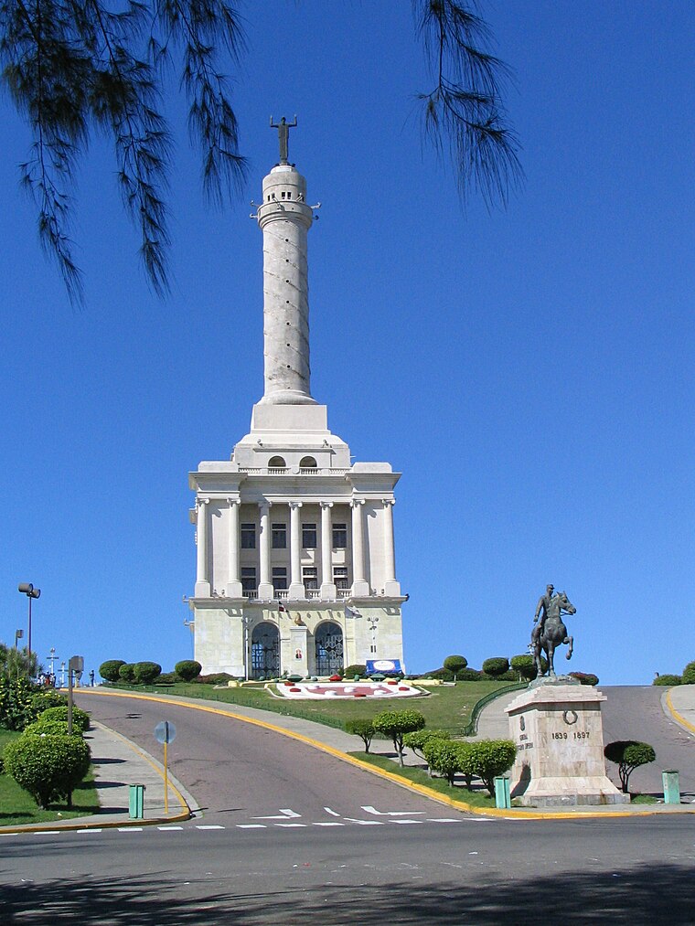
Photo: Casualknit, Public domain.
The Monumento a los Héroes de la Restauración is a monument in the city of Santiago de los Caballeros in the Dominican Republic. It is the highest building in Santiago, and a major tourist attraction for the area. Monumento de Santiago is situated 2½ km southwest of Acacia.
Estadio Cibao FC
Pitch

Photo: Rey del Norte, CC BY 4.0.
Cibao FC Stadium is a football stadium in Santiago de los Caballeros, Dominican Republic. It is currently used for football matches and hosts the home games of Cibao FC of the Liga Dominicana de Fútbol. Estadio Cibao FC is situated 2½ km south of Acacia.
Estadio Cibao
Pitch
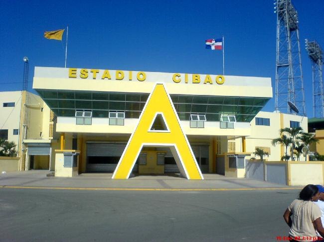
Photo: Advancehg, CC BY-SA 4.0.
The Estadio Cibao is a multi-use stadium in Santiago, Dominican Republic. Currently, it is mostly used for baseball games and hosts the home games of the Águilas Cibaeñas in the Dominican Winter Baseball League. Estadio Cibao is situated 3½ km west of Acacia.
Places in the Area
Nearby places include Tamboríl and Licey al Medio.
Tamboríl
Town
Tamboril is a municipality of the Santiago province in the Dominican Republic. Tamboril is situated in the northeast part of the province, at the foot of the Cordillera Septentrional mountains, at 230 meters above sea level. Tamboríl is situated 7 km east of Acacia.
Licey al Medio
Town
Licey al Medio is a municipality of the Santiago province in the Dominican Republic. Within the municipality there is one municipal district : Las Palomas. The Cibao International Airport is located here. Licey al Medio is situated 9 km southeast of Acacia.
Puñal
Town
Puñal is a city in Santiago Province. Puñal became a rural section of the municipality of Santiago de los Caballeros in 1937, comprising the spots: Guayabal, Matanzas and Laguna Prieta. Puñal is situated 10 km southeast of Acacia.
Acacia
Latitude
19.46877° or 19° 28′ 8″ northLongitude
-70.67687° or 70° 40′ 37″ westOpen location code
77FFF89F+G7OpenStreetMap ID
way 411510562OpenStreetMap feature
landuse=residential
This page is based on OpenStreetMap, Wikidata, and Wikimedia Commons.
We’d love your help improving our open data sources. Thank you for contributing.
Satellite Map
Discover Acacia from above in high-definition satellite imagery.
Places with the Same Name
Discover other places named “Acacia”.
Notable Places Nearby
Highlights include Parroquia San Romon Nonato and Cancha Los Cerritos.
Nearby Places
Explore places such as Colmado La Super Esquina and Mini Market Express.
Western Cibao: Must-Visit Destinations
Delve into Puerto Plata, Sosúa, Monte Cristi, and Bonao.
Curious Residential Areas to Discover
Uncover intriguing residential areas from every corner of the globe.
About Mapcarta. Data © OpenStreetMap contributors and available under the Open Database License". Text is available under the CC BY-SA 4.0 license, except for photos, directions, and the map. Photo: Reimarhoven, CC BY-SA 3.0.