Spielplatz Wachtelstieg
Spielplatz Wachtelstieg is a playground in Braunschweig, Brunswick, Lower Saxony. Spielplatz Wachtelstieg is situated nearby to the playground Spielplatz Bruderstieg, as well as near the church Friedenskirche.| Tap on a place to explore it |
Places of Interest Nearby
Highlights include Hoffmann-von-Fallersleben-Schule and Weißes Ross.
Hoffmann-von-Fallersleben-Schule
School

Photo: Emil Engler, CC BY-SA 4.0.
Hoffmann-von-Fallersleben-Schule is a school, which is situated 290 metres south of Spielplatz Wachtelstieg.
Weißes Ross
Shopping center

Photo: Wikimedia, Public domain.
Weißes Ross is a shopping center, which is situated 660 metres northeast of Spielplatz Wachtelstieg.
Brunswick Cathedral
Church
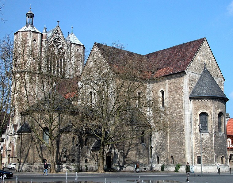
Photo: Brunswyk, Public domain.
Brunswick Cathedral is a large Lutheran church in the City of Braunschweig, Germany. The church is termed Dom, in German a synecdoche - pars pro toto - used for cathedrals and collegiate churches alike, and much like the Italian duomo. Brunswick Cathedral is situated 2 km east of Spielplatz Wachtelstieg.
Places in the Area
Nearby places include Magniviertel and Östliches Ringgebiet.

Östliches Ringgebiet
Suburb

Photo: Brunswyk, CC BY-SA 3.0 de.
The Östliches Ringgebiet is a Stadtbezirk in the eastern part of Braunschweig, Germany. With a population of 26,559 it is the city's second most populous district. Östliches Ringgebiet is situated 3 km east of Spielplatz Wachtelstieg.
Timmerlah
Village

Photo: Redonebird, CC BY-SA 3.0 de.
Timmerlah is a village, which is situated 4½ km southwest of Spielplatz Wachtelstieg.
Spielplatz Wachtelstieg
- Type: Playground
- Category: recreation area
- Location: Braunschweig, Brunswick, Brunswick Land, Lower Saxony, Germany, Central Europe, Europe
- View on OpenStreetMap
Latitude
52.26854° or 52° 16′ 7″ northLongitude
10.49906° or 10° 29′ 57″ eastOpen location code
9F4G7F9X+CJOpenStreetMap ID
way 41572311OpenStreetMap feature
leisure=playground
This page is based on OpenStreetMap, Wikidata, and Wikimedia Commons.
We’d love your help improving our open data sources. Thank you for contributing.
Satellite Map
Discover Spielplatz Wachtelstieg from above in high-definition satellite imagery.
Notable Places Nearby
Highlights include Spielplatz Bruderstieg and Friedenskirche.
Nearby Places
Explore places such as Zahnarztpraxis SaRi 38 and Frisörstübchen Beate Ebeling.
Brunswick Land: Must-Visit Destinations
Delve into Wolfsburg, Salzgitter, Wolfenbüttel, and Helmstedt.
Curious Playgrounds to Discover
Uncover intriguing playgrounds from every corner of the globe.
About Mapcarta. Data © OpenStreetMap contributors and available under the Open Database License". Text is available under the CC BY-SA 4.0 license, except for photos, directions, and the map. Photo: Captaingrog, CC BY-SA 2.5.