Wasserkraftwerk Oberwöhr
Wasserkraftwerk Oberwöhr is an industrial building in Rosenheim, Upper Bavaria, Bavaria which is located on Oberwöhrstraße. Wasserkraftwerk Oberwöhr is situated nearby to the sports venue MTV Rosenheim, as well as near the church Kirche Jesu Christi der Heiligen der Letzten Tage.| Tap on a place to explore it |
Places of Interest Nearby
Highlights include Rosenkranzkönigin and Rosenheim Railway Station.
Rosenkranzkönigin
Church

Photo: Renardo la vulpo, CC BY-SA 4.0.
Rosenkranzkönigin is a church, which is situated 720 metres north of Wasserkraftwerk Oberwöhr.
Rosenheim Railway Station
Railway station
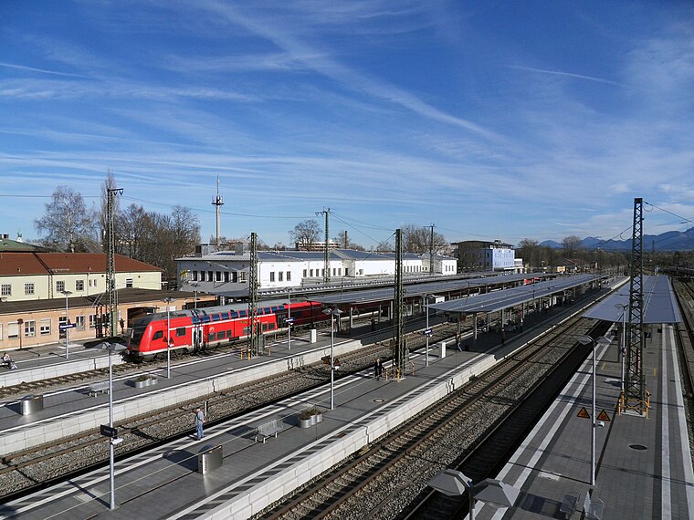
Photo: John-vogel, CC BY-SA 3.0.
Rosenheim station is the main railway station in the city of Rosenheim in Bavaria, Germany. It is the seventh largest passenger station in Bavaria and an important railway hub between the Munich–Rosenheim railway line and the lines to Salzburg, Kufstein/Innsbruck and Mühldorf, as well as the Mangfall Valley Railway. Rosenheim Railway Station is situated 1½ km east of Wasserkraftwerk Oberwöhr.
St. Quirin
Church

Photo: Renardo la vulpo, CC BY-SA 4.0.
St. Quirin is a church, which is situated 1 km north of Wasserkraftwerk Oberwöhr.
Places in the Area
Nearby places include Aising and Pang.

Pang
Village

Photo: Rufus46, CC BY-SA 3.0.
Pang is a village, which is situated 2½ km south of Wasserkraftwerk Oberwöhr.
Kolbermoor
Town

Photo: Rufus46, CC BY-SA 3.0.
Kolbermoor is a town in the district of Rosenheim, in Bavaria, Germany. It is situated 5 km west of Rosenheim on the river Mangfall. In 1859 Kolbermoor railway stop was built for the new Bavarian Maximilian's Railway. Kolbermoor is situated 3 km west of Wasserkraftwerk Oberwöhr.
Wasserkraftwerk Oberwöhr
- Type: Industrial building
- Address: Oberwöhrstraße 54, Rosenheim, 83026
- Categories: building and industry
- Location: Rosenheim, Upper Bavaria, Bavaria, Germany, Central Europe, Europe
- View on OpenStreetMap
Latitude
47.84721° or 47° 50′ 50″ northLongitude
12.09663° or 12° 5′ 48″ eastInception
1896Operator
SWRO GmbHOpen location code
8FVJR3WW+VMOpenStreetMap ID
way 41746619OpenStreetMap feature
building=industrial
This page is based on OpenStreetMap, Wikidata, and Wikimedia Commons.
We’d love your help improving our open data sources. Thank you for contributing.
Satellite Map
Discover Wasserkraftwerk Oberwöhr from above in high-definition satellite imagery.
Notable Places Nearby
Highlights include MTV Rosenheim and Kirche Jesu Christi der Heiligen der Letzten Tage.
Nearby Places
Explore places such as Georg Mackert and Ihr Friseur.
Upper Bavaria: Must-Visit Destinations
Delve into Munich, Ingolstadt, Dachau, and Garmisch-Partenkirchen.
Curious Industrial Buildings to Discover
Uncover intriguing industrial buildings from every corner of the globe.
About Mapcarta. Data © OpenStreetMap contributors and available under the Open Database License". Text is available under the CC BY-SA 4.0 license, except for photos, directions, and the map. Photo: Helmlechner, CC BY-SA 4.0.