Schulgarten Ammersee-Gymnasium
Schulgarten Ammersee-Gymnasium is a garden in Dießen a.Ammersee, Markt, Landsberg, Bavaria. Schulgarten Ammersee-Gymnasium is situated nearby to the pitch Hartplatz Ammersee-Gymnasium, as well as near the sports venue Sportplatz Ammersee-Gymnasium.| Tap on a place to explore it |
Places of Interest Nearby
Highlights include St. Alban and St. Anna.
St. Alban
Church
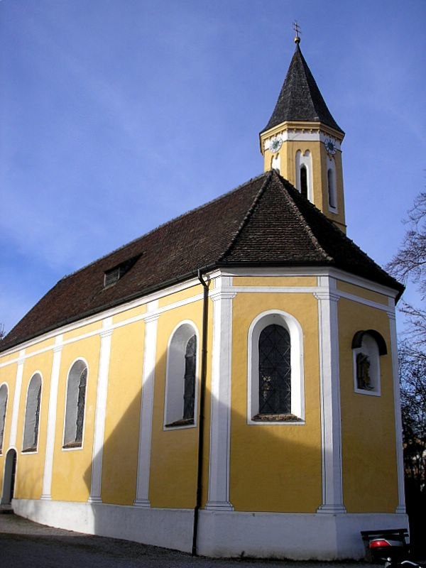
Photo: Dark Avenger, CC BY-SA 3.0.
St. Alban is a church, which is situated 540 metres southeast of Schulgarten Ammersee-Gymnasium.
St. Anna
Church

Photo: K.Baas, CC BY-SA 4.0.
St. Anna is a church, which is situated 790 metres southwest of Schulgarten Ammersee-Gymnasium.
Dießen station
Railway station

Photo: Flummi-2011, CC BY-SA 3.0.
Dießen station is a railway station in the municipality of Dießen am Ammersee, in Bavaria, Germany. It is located on the Mering–Weilheim line of Deutsche Bahn. Dießen station is situated 1½ km south of Schulgarten Ammersee-Gymnasium.
Places in the Area
Nearby places include Romenthal and Bierdorf.


Schulgarten Ammersee-Gymnasium
- Type: Garden
- Category: recreation area
- Location: Dießen a.Ammersee, Markt, Landsberg, Upper Bavaria, Bavaria, Germany, Central Europe, Europe
- View on OpenStreetMap
Latitude
47.964° or 47° 57′ 50″ northLongitude
11.10343° or 11° 6′ 12″ eastOpen location code
8FVHX473+J9OpenStreetMap ID
way 418068510OpenStreetMap feature
leisure=garden
This page is based on OpenStreetMap, Wikidata, and Wikimedia Commons.
We’d love your help improving our open data sources. Thank you for contributing.
Satellite Map
Discover Schulgarten Ammersee-Gymnasium from above in high-definition satellite imagery.
Notable Places Nearby
Highlights include Hartplatz Ammersee-Gymnasium and Sportplatz Ammersee-Gymnasium.
Nearby Places
Explore places such as Ammersee-Gymnasium and St. Alban, Ammerseegymnasium.
Upper Bavaria: Must-Visit Destinations
Delve into Munich, Ingolstadt, Rosenheim, and Dachau.
Curious Gardens to Discover
Uncover intriguing gardens from every corner of the globe.
About Mapcarta. Data © OpenStreetMap contributors and available under the Open Database License". Text is available under the CC BY-SA 4.0 license, except for photos, directions, and the map. Photo: Aconcagua, CC BY-SA 3.0.