Depósito de agua
Depósito de agua is a public building in Murcia Municipality, Murcia, Murcia. Depósito de agua is situated nearby to the museum Museo de Moros y Cristianos, as well as near the college Conservatorio de Música de Murcia.| Tap on a place to explore it |
Places of Interest Nearby
Highlights include Murcia del Carmen Railway Station and Murcia Cathedral.
Murcia del Carmen Railway Station
Railway station
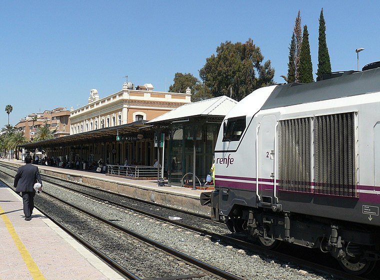
Photo: MOs810, CC BY-SA 4.0.
Murcia del Carmen railway station is the main railway station in the Spanish city of Murcia. Murcia del Carmen Railway Station is situated 610 metres southeast of Depósito de agua.
Murcia Cathedral
Church

Photo: Fernando, CC BY-SA 4.0.
The Cathedral Church of Saint Mary in Murcia, commonly called the Cathedral of Murcia, is a Catholic church in the city of Murcia, Spain. It is the cathedral of the Roman Catholic Diocese of Cartagena. Murcia Cathedral is situated 1 km northeast of Depósito de agua.
Garden of Floridablanca
Park

Photo: Gregorico, CC BY-SA 3.0.
Garden of Floridablanca is a park, which is situated 530 metres northeast of Depósito de agua.
Places in the Area
Nearby places include Nonduermas and Zarandona.
Nonduermas
Neighborhood
Nonduermas is a village and a district in Murcia, Spain. It is part of the municipality of Murcia. Nonduermas is situated 3 km west of Depósito de agua.
Zarandona
Neighborhood
Zarandona is a village in Murcia, Spain. It is part of the municipality of Murcia. Zarandona is situated 3½ km northeast of Depósito de agua.
Rincón de Beniscornia
Neighborhood
Rincón de Beniscornia is a village in Murcia, Spain. It is part of the municipality of Murcia. Rincón de Beniscornia is situated 3½ km west of Depósito de agua.
Depósito de agua
- Type: Public building
- Categories: building, water tower, and government building
- Location: Murcia Municipality, Murcia, Murcia, Eastern Spain, Spain, Iberia, Europe
- View on OpenStreetMap
Latitude
37.97852° or 37° 58′ 43″ northLongitude
-1.13535° or 1° 8′ 7″ westOpen location code
8C9WXVH7+CVOpenStreetMap ID
way 419860457OpenStreetMap feature
building=publicOpenStreetMap feature
man_made=water_tower
This page is based on OpenStreetMap, Wikidata, and Wikimedia Commons.
We’d love your help improving our open data sources. Thank you for contributing.
Satellite Map
Discover Depósito de agua from above in high-definition satellite imagery.
Places with the Same Name
Discover other places named “Depósito de agua”.
Notable Places Nearby
Highlights include Museo de Moros y Cristianos and Conservatorio de Música de Murcia.
Nearby Places
Explore places such as Cuartel de Artillería and Inacua.
Murcia: Must-Visit Destinations
Delve into Cartagena, Lorca, Caravaca de la Cruz, and La Manga.
Curious Public Buildings to Discover
Uncover intriguing public buildings from every corner of the globe.
About Mapcarta. Data © OpenStreetMap contributors and available under the Open Database License". Text is available under the CC BY-SA 4.0 license, except for photos, directions, and the map. Photo: Tango7174, CC BY-SA 4.0.