Bois de la Belle Anguille
Bois de la Belle Anguille is a forest in Saint-Nicolas-de-Redon, Arrondissement of Châteaubriant-Ancenis, Pays de la Loire. Bois de la Belle Anguille is situated nearby to the hamlet La Riaudaie, as well as near Le Rozé.| Tap on a place to explore it |
Places of Interest
Highlights include Redon station and Redon Agglomération.
Redon station
Railway station
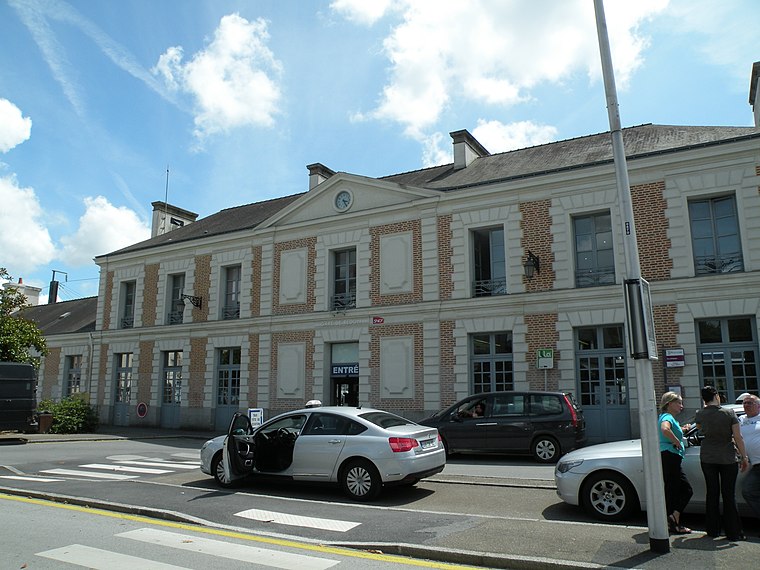
Photo: Pymouss44, CC BY-SA 3.0.
Redon is a railway station serving the town of Redon, Ille-et-Vilaine department, western France. The station is situated on the Rennes–Redon railway and the Savenay–Landerneau railway.
Redon Agglomération
Government office
Redon Agglomération is a French intercommunal structure centred on the city of Redon. It is located in the departments Morbihan, Ille-et-Vilaine and Loire-Atlantique, in the regions Brittany and Pays de la Loire, northwestern France.
Saint-Sauveur Abbey Church of Redon
Church

Photo: Ikmo-ned, CC BY-SA 3.0.
The Saint-Sauveur Abbey Church is a Catholic church situated in Redon, in the French department of Ille-et-Vilaine, in the Brittany region. The church is located to the north of the former Saint-Sauveur Abbey of Redon, where it served as the abbey church until 1790.
Places in the Area
Nearby places include Redon and Sainte-Marie.
Redon
Town

Photo: Fab5669, CC BY-SA 4.0.
Redon is a commune in the Ille-et-Vilaine department in Brittany in northwestern France. It is a sub-prefecture of the department.
Sainte-Marie
Village

Photo: Jinroh001, CC BY-SA 3.0.
Sainte-Marie is a commune in the Ille-et-Vilaine department in Brittany in northwestern France.
Bois de la Belle Anguille
Latitude
47.6595° or 47° 39′ 34″ northLongitude
-2.0568° or 2° 3′ 24″ westOpen location code
8CVVMW5V+R7OpenStreetMap ID
way 42076781OpenStreetMap feature
landuse=forest
This page is based on OpenStreetMap, Wikidata, and Wikimedia Commons.
We’d love your help improving our open data sources. Thank you for contributing.
Satellite Map
Discover Bois de la Belle Anguille from above in high-definition satellite imagery.
Places with the Same Name
Discover other places named “Bois de la Belle Anguille”.
Localities in the Area
Explore places such as La Riaudaie and Le Rozé.
Notable Places Nearby
Highlights include Abdos and Terrain de horse-ball de la ruche..
Pays de la Loire: Must-Visit Destinations
Delve into Montsoreau, Nantes, Angers, and Le Mans.
Curious Forests to Discover
Uncover intriguing forests from every corner of the globe.
About Mapcarta. Data © OpenStreetMap contributors and available under the Open Database License". Text is available under the CC BY-SA 4.0 license, except for photos, directions, and the map. Photo: DakoR, CC BY-SA 3.0.