La Iglesia de Jesucristo de los Santos de los Últimos Días
La Iglesia de Jesucristo de los Santos de los Últimos Días is a church in Callao District, Callao. La Iglesia de Jesucristo de los Santos de los Últimos Días is situated nearby to the fire station Compañía de Bomberos Salvadora Callao Nº 9, as well as near the theater building Teatro Municipal del Callao.| Tap on a place to explore it |
Places of Interest Nearby
Highlights include Real Felipe Fortress and Naval Museum of Peru.
Real Felipe Fortress
Castle
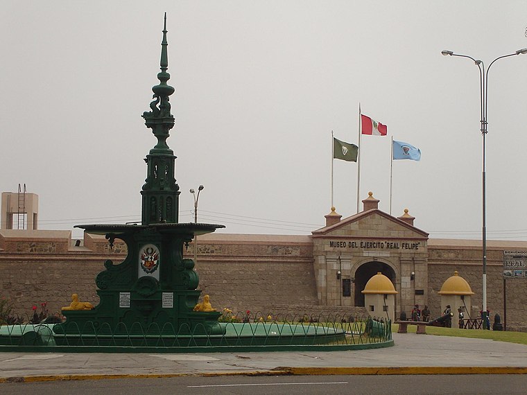
Photo: Rarrunat, Public domain.
The Real Felipe Fortress is a fortress located within the Monumental Zone of Callao, Peru. It was built to defend the main port of the country, as well as the city of Lima from pirates and corsairs during colonial times. Real Felipe Fortress is situated 360 metres west of La Iglesia de Jesucristo de los Santos de los Últimos Días.
Naval Museum of Peru
Museum

Photo: Santiagostucchi, CC BY-SA 4.0.
The Port of Callao, officially the Callao Port Terminal, is the maritime port of Callao, a suburb of Lima, Peru. It is the country's main port in terms of traffic and storage capacity. Naval Museum of Peru is situated 480 metres northwest of La Iglesia de Jesucristo de los Santos de los Últimos Días.
BAP Abtao

Photo: Santiagostucchi, CC BY-SA 4.0.
BAP Abtao is an Abtao-class submarine of the Peruvian Navy. The vessel which was originally named BAP Tiburón, was constructed by the American Electric Boat company in the United States and launched in 1953. BAP Abtao is situated 680 metres northwest of La Iglesia de Jesucristo de los Santos de los Últimos Días.
Places in the Area
Nearby places include West Lima.
West Lima
 Western Lima includes the Chorrillos, San Isidro, Magdalena del Mar, Pueblo Libre, San Miguel districts of Lima, to the south of the Rimac River and west of Av. Arequipa. The related districts of Central Lima, Miraflores and Barranco have their own pages.
La Iglesia de Jesucristo de los Santos de los Últimos Días
- Type: Church
- Denomination: Mormon
- Categories: building, place of worship, and religion
- Location: Callao District, Callao, Callao Region, Central Coast, Peru, South America
- View on OpenStreetMap
Latitude
-12.06332° or 12° 3′ 48″ southLongitude
-77.14575° or 77° 8′ 45″ westOpen location code
57V4WVP3+MMOpenStreetMap ID
way 421930250OpenStreetMap feature
amenity=place_of_worshipOpenStreetMap feature
building=yesOpenStreetMap attribute
denomination=mormon
This page is based on OpenStreetMap, Wikidata, and Wikimedia Commons.
We’d love your help improving our open data sources. Thank you for contributing.
Satellite Map
Discover La Iglesia de Jesucristo de los Santos de los Últimos Días from above in high-definition satellite imagery.
Places with the Same Name
Discover other places named “La Iglesia de Jesucristo de los Santos de los Últimos Días”.
Notable Places Nearby
Highlights include Compañía de Bomberos Salvadora Callao Nº 9 and Teatro Municipal del Callao.
Nearby Places
Explore places such as Bodega Jesus and Centro de Atención Especializado en Adicciones.
Central Coast: Must-Visit Destinations
Delve into Lima, Caral, Central Lima, and Miraflores.
Curious Churches to Discover
Uncover intriguing churches from every corner of the globe.
About Mapcarta. Data © OpenStreetMap contributors and available under the Open Database License". Text is available under the CC BY-SA 4.0 license, except for photos, directions, and the map. Photo: Fausto Cornejo, CC BY-SA 4.0.