Doohlberg
Doohlberg is a meadow in Blaufelden, Schwäbisch Hall, Baden-Württemberg. Doohlberg is situated nearby to the community center Dorfgemeinschaftshaus, as well as near the village Rot am See.| Tap on a place to explore it |
Places of Interest Nearby
Highlights include Bahnhof Rot am See and Burg Flyhöhe.
Bahnhof Rot am See
Railway station
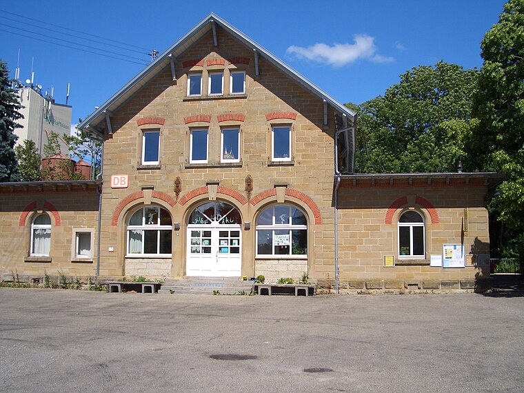
Photo: Hokemo TV, CC BY-SA 3.0.
Bahnhof Rot am See is a railway station, which is situated 3 km south of Doohlberg.
Burg Flyhöhe
Archaeological site

Photo: BerndH, CC BY-SA 3.0.
Burg Flyhöhe is an archaeological site, which is situated 3½ km northwest of Doohlberg.
Ruine Bebenburg
Tower

Photo: BerndH, CC BY-SA 3.0.
Ruine Bebenburg is a tower, which is situated 3½ km southwest of Doohlberg.
Places in the Area
Nearby places include Rot am See and Gammesfeld.
Rot am See
Village

Photo: Wikimedia, CC BY-SA 3.0.
Rot am See is a town in the district of Schwäbisch Hall in Baden-Württemberg in Germany with a population of 5,388 as of December 31, 2018. Rot am See is situated 2½ km south of Doohlberg.

Wallhausen
Village

Photo: Wikimedia, CC BY-SA 1.0.
Wallhausen is a municipality in the district of Schwäbisch Hall in Baden-Württemberg in Germany. It contained the village of Hengstfeld and its hamlets of Asbach, Roßbürg and Schönbronn, incorporated into Wallhausen on 1 July 1974. Wallhausen is situated 8 km south of Doohlberg.
Doohlberg
- Type: Meadow
- Location: Blaufelden, Schwäbisch Hall, Stuttgart, Baden-Württemberg, Germany, Central Europe, Europe
- View on OpenStreetMap
Latitude
49.27701° or 49° 16′ 37″ northLongitude
10.02995° or 10° 1′ 48″ eastOpen location code
8FXG72GH+RXOpenStreetMap ID
way 422583705OpenStreetMap feature
landuse=meadow
This page is based on OpenStreetMap, Wikidata, and Wikimedia Commons.
We’d love your help improving our open data sources. Thank you for contributing.
Satellite Map
Discover Doohlberg from above in high-definition satellite imagery.
Notable Places Nearby
Highlights include Dorfgemeinschaftshaus and Schützenverein Brettenfeld-Rot am See e. V..
Nearby Places
Explore places such as Kreuzer and Hoflädle.
Baden-Württemberg: Must-Visit Destinations
Delve into Stuttgart, Heidelberg, Karlsruhe, and Mannheim.
Curious Meadows to Discover
Uncover intriguing meadows from every corner of the globe.
About Mapcarta. Data © OpenStreetMap contributors and available under the Open Database License". Text is available under the CC BY-SA 4.0 license, except for photos, directions, and the map. Photo: Traveler100, CC BY-SA 3.0.