Bizkaiko Jolas Parke zaharra
Bizkaiko Jolas Parke zaharra is a ruins in Galdakao, Biscay, Basque Country. Bizkaiko Jolas Parke zaharra is situated nearby to the peak Oleatatxu, as well as near the mountain saddle Ganguren.| Tap on a place to explore it |
Places of Interest Nearby
Highlights include Ganguren and Santa Marina Ospitalea.

Santa Marina Ospitalea
Hospital

Photo: Kulmalukko, CC BY-SA 3.0.
Santa Marina Ospitalea is a hospital, which is situated 1½ km northwest of Bizkaiko Jolas Parke zaharra.
Ariz station
Railway station
 Ariz is a railway station in Basauri, Basque Country, Spain. It is owned by Euskal Trenbide Sarea and operated by Euskotren. It lies on the Bilbao–San Sebastián line. Ariz station is situated 2 km southwest of Bizkaiko Jolas Parke zaharra.
Places in the Area
Nearby places include Etxebarri and Legizamon.
Etxebarri
Town
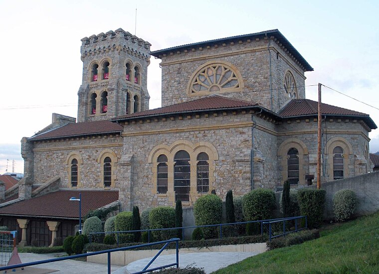
Photo: Zarateman, CC BY-SA 4.0.
Etxebarri, Doneztebeko Elizatea is a town and municipality located in the province of Biscay, in the Autonomous Basque Community, in the North of Spain.

Ocharcoaga
Quarter
 Ocharcoaga is a quarter, which is situated 2½ km west of Bizkaiko Jolas Parke zaharra.
Bizkaiko Jolas Parke zaharra
- Type: Ruins
- Categories: brownfield land and historic site
- Location: Galdakao, Biscay, Basque Country, Northern Spain, Spain, Iberia, Europe
- View on OpenStreetMap
Latitude
43.25383° or 43° 15′ 14″ northLongitude
-2.86645° or 2° 51′ 59″ westOpen location code
8CMV743M+GCOpenStreetMap ID
way 42277641OpenStreetMap feature
historic=ruinsOpenStreetMap feature
landuse=brownfield
This page is based on OpenStreetMap, Wikidata, and Wikimedia Commons.
We’d love your help improving our open data sources. Thank you for contributing.
Satellite Map
Discover Bizkaiko Jolas Parke zaharra from above in high-definition satellite imagery.
In Other Languages
From Basque to Spanish—“Bizkaiko Jolas Parke zaharra” goes by many names.
- Basque: “Bizkaiko Jolas Parke zaharra”
- Spanish: “Antiguo Parque de Atracciones de Vizcaya”
Notable Places Nearby
Highlights include Oleatatxu and Ganguren.
Nearby Places
Explore places such as Antigua charca del antiguo parque and Lago del Parque de Atracciones.
Basque Country: Must-Visit Destinations
Delve into Bilbao, San Sebastián, Vitoria-Gasteiz, and Guernica.
Curious Ruins to Discover
Uncover intriguing ruins from every corner of the globe.
About Mapcarta. Data © OpenStreetMap contributors and available under the Open Database License". Text is available under the CC BY-SA 4.0 license, except for photos, directions, and the map. Photo: Ander Abadia Zallo, CC BY 4.0.