Pavelló esportiu
Pavelló esportiu is a sports venue in Camprodon, Girona, Catalonia. Pavelló esportiu is situated nearby to El Gat Miau, as well as near the park Plaça de Santa Maria.| Tap on a place to explore it |
Places of Interest Nearby
Highlights include Església de Santa Maria de Camprodon and Sant Pere, Camprodon.
Església de Santa Maria de Camprodon
Church

Photo: Baldiri, CC BY-SA 3.0.
Església de Santa Maria de Camprodon is a church, which is situated 110 metres northeast of Pavelló esportiu.
Sant Pere, Camprodon
Church
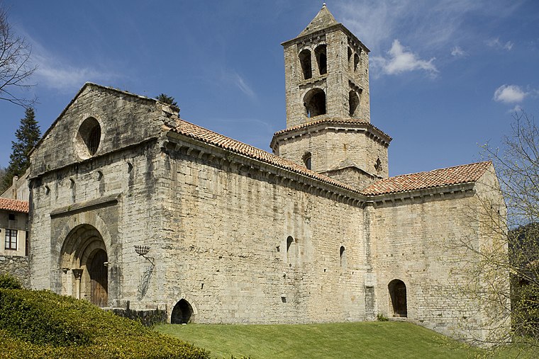
Photo: PMRMaeyaert, CC BY-SA 3.0 es.
Sant Pere de Camprodon is a Benedictine monastery in Camprodon, Ripollès, Catalonia, Spain. It was declared a Bien de Interés Cultural landmark in 1931. Sant Pere, Camprodon is situated 200 metres northeast of Pavelló esportiu.
Birba Biscuits
Historic building
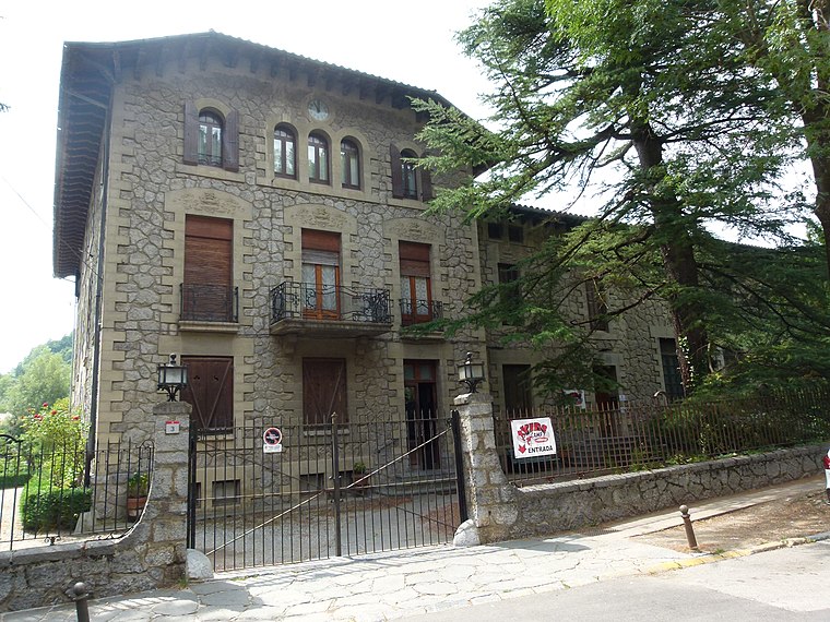
Photo: Jordiipa, CC BY-SA 3.0.
Birba Biscuits is a historic building, which is situated 430 metres northwest of Pavelló esportiu.
Places in the Area
Nearby places include Llanars and Colònia Estabanell.
Llanars
Village
Llanars is a municipality in the Pyrenean comarca of Ripollès in Girona, Catalonia, Spain. The parish church is a Romanesque church: Sant Esteve de Llanars. The village name is documented from the 1068, with the Llenars form.

Pavelló esportiu
- Type: Sports venue
- Categories: building, recreation area, and sports location
- Location: Camprodon, Girona, Catalonia, Eastern Spain, Spain, Iberia, Europe
- View on OpenStreetMap
Latitude
42.31313° or 42° 18′ 47″ northLongitude
2.36779° or 2° 22′ 4″ eastOpen location code
8FJ48979+74OpenStreetMap ID
way 423778946OpenStreetMap feature
building=pavilionOpenStreetMap feature
leisure=sports_centre
This page is based on OpenStreetMap, Wikidata, and Wikimedia Commons.
We’d love your help improving our open data sources. Thank you for contributing.
Satellite Map
Discover Pavelló esportiu from above in high-definition satellite imagery.
In Other Languages
“Pavelló esportiu” goes by many names.
- Catalan: “Pavelló esportiu”
Places with the Same Name
Discover other places named “Pavelló esportiu”.
Notable Places Nearby
Highlights include El Gat Miau and Plaça de Santa Maria.
Nearby Places
Explore places such as Els Hospitals de la Retirada and Travessa.
Girona: Must-Visit Destinations
Delve into Girona, Figueres, Llivia, and Lloret de Mar.
Curious Sports Venues to Discover
Uncover intriguing sports venues from every corner of the globe.
About Mapcarta. Data © OpenStreetMap contributors and available under the Open Database License". Text is available under the CC BY-SA 4.0 license, except for photos, directions, and the map. Photo: Wikimedia, CC0.