THW Ortsverband Kulmbach
THW Ortsverband Kulmbach is an office building in Kulmbach, Upper Franconia, Bavaria which is located on Von-Linde-Straße. THW Ortsverband Kulmbach is situated nearby to the health club KA2 - Sport-Freizeit-Gesundheit GbR, as well as near the church Evangelische.| Tap on a place to explore it |
- Email: ov-kulmbach@thw.de
- Type: Office building
- Address: Von-Linde-Straße 15, Kulmbach, 95326
Places of Interest Nearby
Highlights include Evangelische and St. Nikolai.
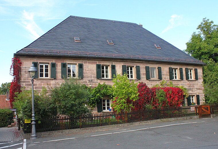
Evangelische
Church

Photo: Benreis, CC BY-SA 3.0.
Evangelische is a church, which is situated 690 metres east of THW Ortsverband Kulmbach.
St. Nikolai
Church

Photo: Benreis, CC BY-SA 3.0.
St. Nikolai is a church, which is situated 2 km northeast of THW Ortsverband Kulmbach.
Caspar-Vischer-Gymnasium
School
 Caspar-Vischer-Gymnasium is a school, which is situated 1½ km east of THW Ortsverband Kulmbach.
Places in the Area
Nearby places include Burghaig and Petzmannsberg.


THW Ortsverband Kulmbach
- Categories: building and office
- Location: Kulmbach, Kulmbach, Upper Franconia, Franconia, Bavaria, Germany, Central Europe, Europe
- View on OpenStreetMap
Latitude
50.09837° or 50° 5′ 54″ northLongitude
11.42591° or 11° 25′ 33″ eastHeight
10 metres (33 feet)Operator
Technisches HilfswerkOpen location code
9F2H3CXG+89OpenStreetMap ID
way 427472725OpenStreetMap feature
building=office
This page is based on OpenStreetMap, Wikidata, and Wikimedia Commons.
We’d love your help improving our open data sources. Thank you for contributing.
Satellite Map
Discover THW Ortsverband Kulmbach from above in high-definition satellite imagery.
Notable Places Nearby
Highlights include KA2 - Sport-Freizeit-Gesundheit GbR and Friedhof.
Nearby Places
Explore places such as dc AG and Büro Heiß - Bürobedarf.
Upper Franconia: Must-Visit Destinations
Delve into Bamberg, Bayreuth, Coburg, and Hof.
Curious Office Buildings to Discover
Uncover intriguing office buildings from every corner of the globe.
About Mapcarta. Data © OpenStreetMap contributors and available under the Open Database License". Text is available under the CC BY-SA 4.0 license, except for photos, directions, and the map. Photo: Wikimedia, CC0.