Ferienhof Schmelmer
Ferienhof Schmelmer is a residential building in Drachselsried, Regen, Bavaria. Ferienhof Schmelmer is situated nearby to the peak Riesberg, as well as near Weigelsberg.| Tap on a place to explore it |
Places of Interest Nearby
Highlights include Weigelsberg and St. Ägidius.
St. Ägidius
Church

Photo: Konrad Lackerbeck, CC BY 3.0.
St. Ägidius is a church, which is situated 2 km northeast of Ferienhof Schmelmer.
Arnbruck airfield
Aerodrome
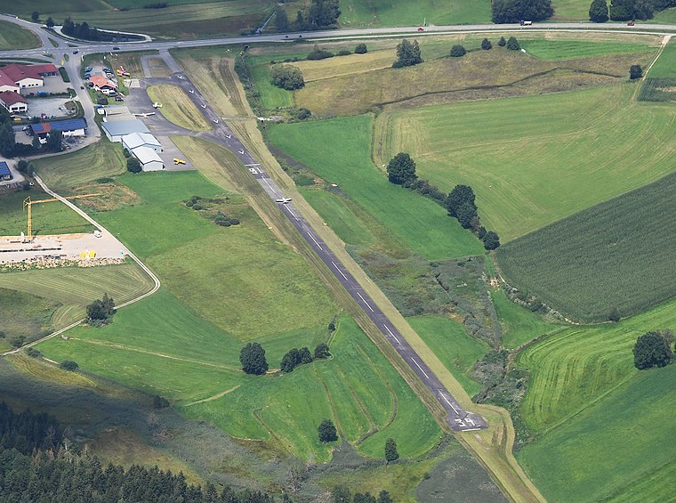
Photo: Carsten Steger, CC BY-SA 4.0.
Arnbruck airfield is an aerodrome, which is situated 3½ km north of Ferienhof Schmelmer.
Places in the Area
Nearby places include Arnbruck and Böbrach.
Arnbruck
Village

Photo: Konrad Lackerbeck, CC BY 3.0.
Arnbruck is a municipality in the district of Regen, in Bavaria, Germany. Arnbruck is situated 4 km north of Ferienhof Schmelmer.
Böbrach
Village

Photo: Konrad Lackerbeck, CC BY 3.0.
Böbrach is a municipality in the district of Regen, in Bavaria, Germany. Böbrach is situated 5 km southeast of Ferienhof Schmelmer.
Blossersberg
Village

Photo: Konrad Lackerbeck, CC0.
Blossersberg is a village, which is situated 7 km west of Ferienhof Schmelmer.
Ferienhof Schmelmer
- Type: Residential building
- Category: building
- Location: Drachselsried, Regen, Lower Bavaria, Bavaria, Germany, Central Europe, Europe
- View on OpenStreetMap
Latitude
49.09551° or 49° 5′ 44″ northLongitude
12.99084° or 12° 59′ 27″ eastOpen location code
8FXJ3XWR+68OpenStreetMap ID
way 429442336OpenStreetMap feature
building=residential
This page is based on OpenStreetMap, Wikidata, and Wikimedia Commons.
We’d love your help improving our open data sources. Thank you for contributing.
Satellite Map
Discover Ferienhof Schmelmer from above in high-definition satellite imagery.
Notable Places Nearby
Highlights include Kapelle Grafenried and Naturbad Drachselsried.
Nearby Places
Explore places such as Ferienhof Schmelmer and Grund.
Lower Bavaria: Must-Visit Destinations
Delve into Passau, Landshut, Straubing, and Deggendorf.
Curious Residential Buildings to Discover
Uncover intriguing residential buildings from every corner of the globe.
About Mapcarta. Data © OpenStreetMap contributors and available under the Open Database License". Text is available under the CC BY-SA 4.0 license, except for photos, directions, and the map. Photo: Wikimedia, CC0.