Regionalwärme Wurdach
Regionalwärme Wurdach is an industrial building in Köttmannsdorf, Klagenfurt-Land District, Carinthia. Regionalwärme Wurdach is situated nearby to the fire station Freiwillige Feuerwehr Wurdach, as well as near the peak Plöschenberg.| Tap on a place to explore it |
Places of Interest Nearby
Highlights include Baßgeigensee and Totenleuchte Köttmannsdorf.
Baßgeigensee

Photo: Johann Jaritz, CC BY-SA 3.0.
Baßgeigensee is a lake of Carinthia, Austria. Baßgeigensee is situated 1½ km north of Regionalwärme Wurdach.
Totenleuchte Köttmannsdorf

Photo: Johann Jaritz, CC BY-SA 4.0.
Totenleuchte Köttmannsdorf is situated 2½ km southeast of Regionalwärme Wurdach.
Rauschelesee
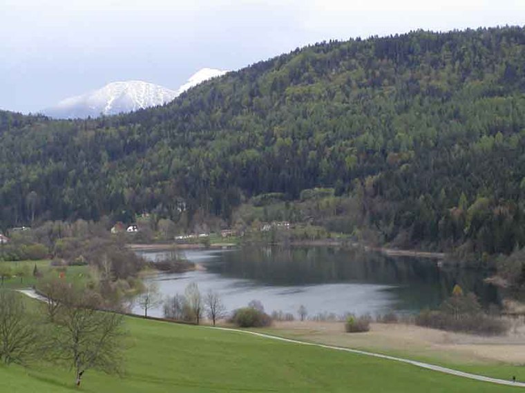
Photo: Rauschelesee, CC BY 2.5.
Rauschelesee is a lake in Keutschacher Seental near Lake Keutschach in the town Keutschach, Carinthia, Austria. The lake is used for fishing and swimming.
Places in the Area
Nearby places include Keutschach am See and Krumpendorf am Wörthersee.
Keutschach am See
Village
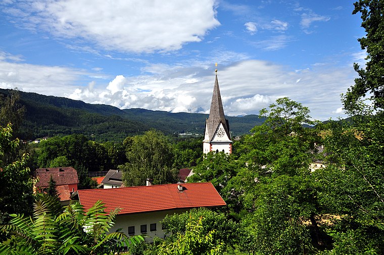
Photo: Johann Jaritz, CC BY-SA 3.0.
Keutschach am See is a municipality in the district of Klagenfurt-Land in the Austrian state of Carinthia. Keutschach am See is situated 2½ km northwest of Regionalwärme Wurdach.
Krumpendorf am Wörthersee
Village

Photo: Wikimedia, Public domain.
Krumpendorf am Wörthersee is a municipality in Klagenfurt-Land District, in Carinthia, Austria. It is situated on the Wörthersee. Krumpendorf am Wörthersee is situated 6 km north of Regionalwärme Wurdach.
Suetschach
Village

Photo: Johann Jaritz, CC BY-SA 3.0.
Suetschach is a village, which is situated 7 km southwest of Regionalwärme Wurdach.
Regionalwärme Wurdach
- Type: Industrial building
- Postal code: 9071
- Categories: building and industry
- Location: Köttmannsdorf, Klagenfurt-Land District, Carinthia, Austria, Central Europe, Europe
- View on OpenStreetMap
Latitude
46.57273° or 46° 34′ 22″ northLongitude
14.20257° or 14° 12′ 9″ eastOpen location code
8FRPH6F3+32OpenStreetMap ID
way 434908047OpenStreetMap feature
building=industrial
This page is based on OpenStreetMap, Wikidata, and Wikimedia Commons.
We’d love your help improving our open data sources. Thank you for contributing.
Satellite Map
Discover Regionalwärme Wurdach from above in high-definition satellite imagery.
Notable Places Nearby
Highlights include Freiwillige Feuerwehr Wurdach and Plöschenberg.
Nearby Places
Explore places such as Buschenschank Jaritz and Mostetschnig.
Carinthia: Must-Visit Destinations
Delve into Klagenfurt, Villach, Wörthersee, and Spittal an der Drau.
Curious Industrial Buildings to Discover
Uncover intriguing industrial buildings from every corner of the globe.
About Mapcarta. Data © OpenStreetMap contributors and available under the Open Database License". Text is available under the CC BY-SA 4.0 license, except for photos, directions, and the map. Photo: Wikimedia, CC BY-SA 3.0.