Amberg Industriegebiet Süd
Amberg Industriegebiet Süd is in Amberg, Upper Palatinate, Bavaria. Amberg Industriegebiet Süd is situated nearby to Lüdecke Park, as well as near the health club Fit Light Fitnesstudio.| Tap on a place to explore it |
Places of Interest Nearby
Highlights include St. Martin and Electoral Palace.
St. Martin
Church
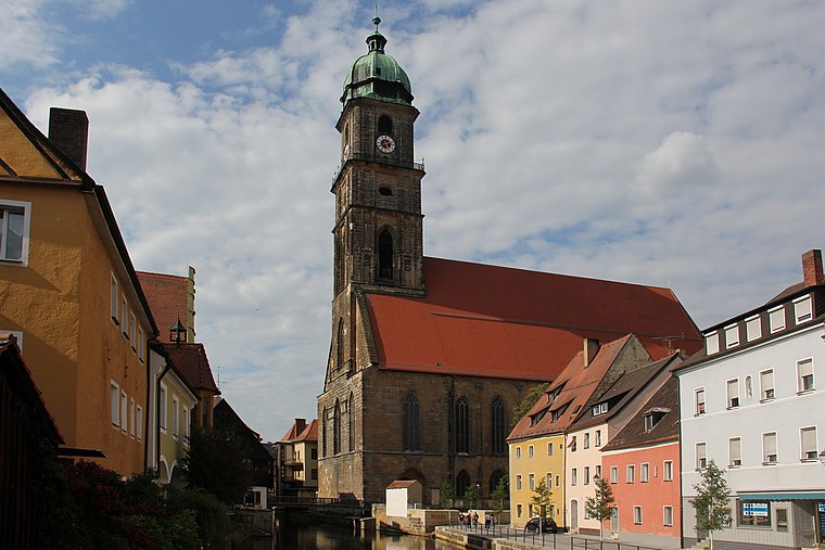
Photo: Mattis, CC BY-SA 3.0.
St. Martin is a church, which is situated 1½ km north of Amberg Industriegebiet Süd.
Electoral Palace

Photo: Threadder, CC BY-SA 3.0.
The Electoral Palace is a Schloss in Amberg. After several large fires in the 17th century, only the south wing remains from the once three-winged palace. Electoral Palace is situated 1½ km north of Amberg Industriegebiet Süd.
Amberg City Museum
Museum

Photo: Museum amb, CC BY-SA 4.0.
Amberg City Museum is situated 1½ km north of Amberg Industriegebiet Süd.
Places in the Area
Nearby places include Haselmühl and Gailoh.


Köfering
Village

Photo: DALIBRI, CC BY-SA 4.0.
Köfering is a village, which is situated 2½ km south of Amberg Industriegebiet Süd.
Amberg Industriegebiet Süd
- Type: Industry
- Location: Amberg, Upper Palatinate, Bavaria, Germany, Central Europe, Europe
- View on OpenStreetMap
Latitude
49.43043° or 49° 25′ 50″ northLongitude
11.86312° or 11° 51′ 47″ eastOpen location code
8FXHCVJ7+56OpenStreetMap ID
way 44332490OpenStreetMap feature
landuse=industrial
This page is based on OpenStreetMap, Wikidata, and Wikimedia Commons.
We’d love your help improving our open data sources. Thank you for contributing.
Satellite Map
Discover Amberg Industriegebiet Süd from above in high-definition satellite imagery.
Notable Places Nearby
Highlights include Lüdecke Park and Fit Light Fitnesstudio.
Nearby Places
Explore places such as Geb. 37, Zentrallager and Geb. 31.
Upper Palatinate: Must-Visit Destinations
Delve into Regensburg, Cham, Schwandorf, and Grafenwöhr.
Curious Places to Discover
Uncover intriguing places from every corner of the globe.
About Mapcarta. Data © OpenStreetMap contributors and available under the Open Database License". Text is available under the CC BY-SA 4.0 license, except for photos, directions, and the map. Photo: Mattis, CC BY-SA 3.0.