Landesbetrieb Mess- und Eichwesen
Landesbetrieb Mess- und Eichwesen is a government office in Cologne District, North Rhine-Westphalia which is located on Hugo-Eckener-Straße. Landesbetrieb Mess- und Eichwesen is situated nearby to the health club Flexx Fitness, as well as near the sports venue Adrenalinpark.| Tap on a place to explore it |
- Opening hours: Monday—Friday 8:30 AM—noon, Monday, and Wednesday 2:00 PM—3:00 PM
- Email: poststelle.koeln@lbme.nrw.de
- Type: Government office
- Address: Hugo-Eckener-Straße 14, Köln, 50829
Places of Interest Nearby
Highlights include Westfriedhof and Epiphaniaskirche.
Westfriedhof
Cemetery

Photo: Wikimedia, CC BY-SA 3.0.
Westfriedhof is a cemetery in Cologne, Germany. With an area of 52 hectares, it is amongst the largest of the cemeteries in the city. Romani holocaust survivor, Philomena Franz, is buried in the cemetery. Westfriedhof is situated 1¼ km southwest of Landesbetrieb Mess- und Eichwesen.
Epiphaniaskirche
Church

Photo: Chris06, CC BY-SA 4.0.
Epiphaniaskirche is a church, which is situated 1¼ km south of Landesbetrieb Mess- und Eichwesen.
St. Dreikönigen
Church
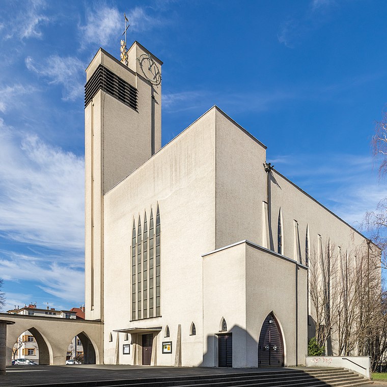
Photo: Wikimedia, CC BY-SA 4.0.
St. Dreikönigen is a church, which is situated 2 km south of Landesbetrieb Mess- und Eichwesen.
Places in the Area
Nearby places include Bickendorf and Longerich.

Longerich
Suburb

Photo: Maximilian Schönherr, CC BY-SA 4.0.
Longerich is a suburb, which is situated 2½ km northeast of Landesbetrieb Mess- und Eichwesen.
Bilderstöckchen
Suburb

Photo: Superbass, CC BY-SA 3.0.
Nippes is the fifth borough of Cologne, Germany. Nippes was incorporated into the city of Cologne in 1888 and the district was created in 1975. A large Ford Europe production plant is located in Niehl, the north-eastern part of the district. Bilderstöckchen is situated 2½ km southeast of Landesbetrieb Mess- und Eichwesen.
Landesbetrieb Mess- und Eichwesen
- Categories: building, office, and government building
- Location: Cologne District, North Rhine-Westphalia, Germany, Central Europe, Europe
- View on OpenStreetMap
Latitude
50.97803° or 50° 58′ 41″ northLongitude
6.89499° or 6° 53′ 42″ eastOpen location code
9F28XVHV+6XOpenStreetMap ID
way 44452016OpenStreetMap feature
building=yesOpenStreetMap feature
office=government
This page is based on OpenStreetMap, Wikidata, and Wikimedia Commons.
We’d love your help improving our open data sources. Thank you for contributing.
Satellite Map
Discover Landesbetrieb Mess- und Eichwesen from above in high-definition satellite imagery.
Notable Places Nearby
Highlights include Flexx Fitness and Adrenalinpark.
Nearby Places
Explore places such as Shell and Bildungszentrum Butzweiler Hof.
North Rhine-Westphalia: Must-Visit Destinations
Delve into Cologne, Düsseldorf, Bonn, and Dortmund.
Curious Government Offices to Discover
Uncover intriguing government offices from every corner of the globe.
About Mapcarta. Data © OpenStreetMap contributors and available under the Open Database License". Text is available under the CC BY-SA 4.0 license, except for photos, directions, and the map. Photo: Daniel Schwen, CC BY-SA 2.5.